|
search place name
|
||
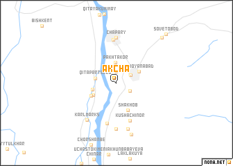
Akcha (Khatlon, Tajikistan)Akcha is a town in the Khatlon region of Tajikistan. An overview map of the region around Akcha is displayed below.
regional and 3d topo map of Akcha, Tajikistan ::
Akcha airports ::
The nearest airport is UND - Kunduz Konduz, located 105.1 km south east of Akcha.
Other airports nearby include MZR - Mazar-i-sharif Mazar I Sharif (114.8 km south west), DYU - Dushanbe (139.4 km north east), Nearby towns ::
Khokak (1.8km north) //
Arabkhonai Kalon (2.1km south east) //
Qabodiyon (2.3km north east) //
Pakhtakor (3.3km north) //
Qit'a Parts'ezd (2.8km west) //
Uchastok Beshkappa (3.2km west) //
Chorbog (3.4km north east) //
Mikoyanabad (3.4km north east) //
Nizhniy Khokak (3.6km south west) //
Qit'a Qizilobod (3.9km south west) //
Shakhob (4.6km south) //
Kushachinor (6.3km south) //
Beshtemir (6.7km south) //
Boshqal'a (7.0km north) //
Chapary (7.4km north) //
Sangova (7.5km south) //
Karl Marks (7.1km south west) //
Charshma (7.6km south) //
Dokki (8.6km south) //
Imeni Nasir Khisrav (9.4km north east) //
Sovetobod (10.1km north east) //
[all distances 'as the bird flies' and approximate]  Places with similar names to Akcha, Tajikistan ::
Disclaimer :: Information on this page comes without warranty of any kind |
||
|
Where is Akcha? Elevation and coordinates ::
Latitude (lat): 37°24'2"N Longitude (lon): 68°10'2"E
Elevation (approx.): 392m (map arrows pan, magnifying glasses zoom) |
||
|
Visiting Akcha? Hotel/Accommodation ::
Book a hotel in Akcha Travel Guide ::
Buy a travel guide for Tajikistan rental cars ::
car rental offers GPS waypoint ::
download a GPX waypoint (PoI) of Akcha for your GPS receiver
|
||