|
search place name
|
||
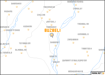
Buzbeli ((( Kulyabskaya Oblast' )), Tajikistan)Buzbeli is a town in the (( Kulyabskaya Oblast' )) region of Tajikistan. An overview map of the region around Buzbeli is displayed below.
regional and 3d topo map of Buzbeli, Tajikistan ::
Buzbeli airports ::
The nearest airport is DYU - Dushanbe, located 81.5 km north west of Buzbeli.
Other airports nearby include UND - Kunduz Konduz (171.8 km south), Nearby towns ::
Tobashor (2.7km north) //
Shibonay (2.9km south) //
Jantokli (4.5km north) //
Davatkhalqaer (6.6km north) //
Zangi-Baba (6.1km east) //
Sovety (7.9km south) //
Chilcha (7.6km north west) //
Kushkak (7.4km north west) //
[all distances 'as the bird flies' and approximate] 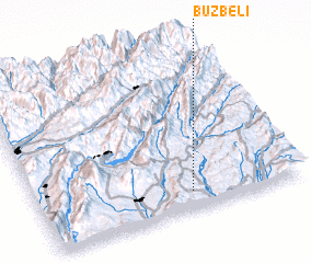 Places with similar names to Buzbeli, Tajikistan ::
// Bozbel (TR)
// Basibila (CD)
// Bosobolo (CD)
// Busabelo (ID)
// Basabli (GH)
// Bisbeel (LB)
// Basubila (ZM)
// Buzbela (PK)
// Basse Bleu (HT)
// Bois Boulé (HT)
Disclaimer :: Information on this page comes without warranty of any kind |
||
|
Where is Buzbeli? Elevation and coordinates ::
Latitude (lat): 38°7'0"N Longitude (lon): 69°35'0"E
Elevation (approx.): 862m (map arrows pan, magnifying glasses zoom) |
||
|
Visiting Buzbeli? Hotel/Accommodation ::
Book a hotel in Buzbeli Travel Guide ::
Buy a travel guide for Tajikistan rental cars ::
car rental offers GPS waypoint ::
download a GPX waypoint (PoI) of Buzbeli for your GPS receiver
|
||