|
search place name
|
||
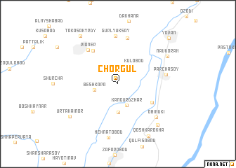
Chorgul ((( Kulyabskaya Oblast' )), Tajikistan)Chorgul is a town in the (( Kulyabskaya Oblast' )) region of Tajikistan. An overview map of the region around Chorgul is displayed below.
regional and 3d topo map of Chorgul, Tajikistan ::
Chorgul airports ::
The nearest airport is DYU - Dushanbe, located 35.2 km north of Chorgul.
Other airports nearby include UND - Kunduz Konduz (175.7 km south), MZR - Mazar-i-sharif Mazar I Sharif (231.3 km south west), SKD - Samarkand (235.9 km north west), Nearby towns ::
Kangur-Dzhar (3.6km south) //
Kulobod (3.4km north east) //
Beshkapa (3.1km west) //
Tagayobod (4.5km south) //
Dashtobod (5.2km south east) //
Naryn (6.2km north west) //
Pioner (6.6km north west) //
Garav (7.4km north) //
Gurlyuk-Say (7.7km north) //
Parchasoy (6.2km east) //
Obimuki (7.1km south east) //
Mehnatobod (8.6km south) //
Navkoram (7.6km north east) //
Kirgochak (8.3km south east) //
Urtakaínor (7.9km south west) //
Qoshkarokha (9.1km south east) //
Taka-Sakyrdy (9.0km north west) //
Yovan (9.7km north east) //
[all distances 'as the bird flies' and approximate]  Places with similar names to Chorgul, Tajikistan ::
// Shyrokyy Luh (UA)
// Charkli (RU)
// Charīklū (IR)
// Chārqolī (IR)
// Charāikol (BD)
// Chāraikola (BD)
// Char Goāli (BD)
// Char Kāli (BD)
// Char Kāli (BD)
// Churigualla (CL)
Disclaimer :: Information on this page comes without warranty of any kind |
||
|
Where is Chorgul? Elevation and coordinates ::
Latitude (lat): 38°14'51"N Longitude (lon): 68°58'14"E
Elevation (approx.): 586m (map arrows pan, magnifying glasses zoom) |
||
|
Visiting Chorgul? Hotel/Accommodation ::
Book a hotel in Chorgul Travel Guide ::
Buy a travel guide for Tajikistan rental cars ::
car rental offers GPS waypoint ::
download a GPX waypoint (PoI) of Chorgul for your GPS receiver
|
||