|
search place name
|
||
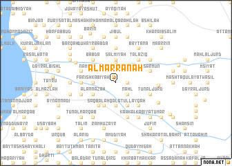
Al Marrānah (Al Lādhiqīyah, Syria)Al Marrānah is a town in the Al Lādhiqīyah region of Syria. An overview map of the region around Al Marrānah is displayed below.
regional and 3d topo map of Al Marrānah, Syria ::
Al Marrānah airports ::
The nearest airport is LTK - Latakia Bassel Al Assad Intl, located 25.5 km north west of Al Marrānah.
Other airports nearby include ALP - Aleppo Intl (150.0 km north east), BEY - Beirut Rafic Hariri Intl (162.4 km south), DAM - Damascus Intl (202.4 km south), ADA - Adana Incirlik Ab (208.5 km north), Nearby towns ::
Fuwayrisāt al Gharbīyah (1.9km north) //
Ad Dardārah (1.5km east) //
Wādī al Birkah (1.5km east) //
Ḩarf as Sâri (2.4km north west) //
Bayt Zahrān (2.4km north west) //
Quşaybah (2.4km north east) //
Fuwayrisāt ash Sharqīyah (2.4km north east) //
Naḩl (2.4km south east) //
Bayt Wazan (3.2km north) //
Al Mushayrifah (3.7km north) //
Salmīyah (3.7km north) //
Al Ghunşalah (3.7km south) //
Fārish Ka‘bīyah (3.0km west) //
Khirbat Kasīḩ (4.0km south) //
Na‘mū al Jurd (3.6km north west) //
Al ‘Annāzah (3.6km south west) //
Qal‘at ‘Ullayqah (4.0km south) //
Saqbalah (4.3km south west) //
Ar Rabbāşah (4.8km north west) //
B‘abdā (4.8km north west) //
Talāzīq (4.8km north east) //
An Nawāqīr (4.8km north east) //
Fāsān (4.8km south east) //
Bayt al ‘Allūnī (5.6km north) //
Bustān al Ḩammām (4.5km west) //
Turaymīsah (4.5km west) //
Bşarmūn (4.9km east) //
Al Juwaybāt (4.9km west) //
Tūn al Jurd (4.9km east) //
[all distances 'as the bird flies' and approximate] 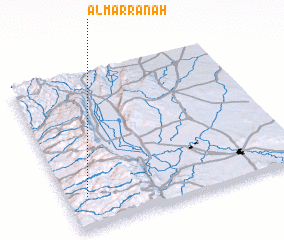 Places with similar names to Al Marrānah, Syria ::
// Alì Marina (IT)
// Al Amrīnī (IQ)
// Ālmarān (IR)
// Al Marān (SY)
// Al Marrānah (SY)
// Al ‘Amārinah (EG)
// Al ‘Umrān (TN)
// Al ‘Amārīn (SD)
// Al ‘Umrān (SA)
// Almeriana (BR)
Disclaimer :: Information on this page comes without warranty of any kind |
||
|
Where is Al Marrānah? Elevation and coordinates ::
Latitude (lat): 35°12'0"N Longitude (lon): 36°5'0"E
Elevation (approx.): 762m (map arrows pan, magnifying glasses zoom) |
||
|
Visiting Al Marrānah? Hotel/Accommodation ::
Book a hotel in Al Marrānah Travel Guide ::
Buy a travel guide for Syria rental cars ::
car rental offers GPS waypoint ::
download a GPX waypoint (PoI) of Al Marrānah for your GPS receiver
|
||