|
search place name
|
||
Ash Shaykh ‘Alī Kāsūn (Ḩamāh, Syria)Ash Shaykh ‘Alī Kāsūn is a town in the Ḩamāh region of Syria. An overview map of the region around Ash Shaykh ‘Alī Kāsūn is displayed below.
regional and 3d topo map of Ash Shaykh ‘Alī Kāsūn, Syria ::

Ash Shaykh ‘Alī Kāsūn airports ::
The nearest airport is LTK - Latakia Bassel Al Assad Intl, located 97.2 km west of Ash Shaykh ‘Alī Kāsūn.
Other airports nearby include ALP - Aleppo Intl (112.8 km north), PMS - Palmyra (140.3 km south east), GZT - Gaziantep Oguzeli (200.7 km north), DAM - Damascus Intl (201.3 km south), Nearby towns ::
Khaybah (2.4km north west) //
Ţirād (4.0km south) //
Sibā‘ (4.0km south) //
Tamak (3.6km south east) //
Tall adh Dhahab (3.6km north east) //
Al Bardūnah (5.8km north) //
Ḩalbān (5.8km north) //
Umm Tuwaynah al Janūbīyah (5.9km south east) //
Nawá (6.1km east) //
Ar Rubbah (7.6km south) //
Dnīn (6.3km west) //
Al Buwayḑah (7.2km south east) //
Al ‘Anz (8.0km north) //
Ţayyibat at Turkī (8.2km north west) //
Al Lāḩūnah (8.2km south west) //
Abū Ţuwayqīyah (9.6km south west) //
Umm Turaykīyah al Qiblīyah (9.6km north east) //
[all distances 'as the bird flies' and approximate] 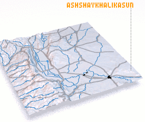 Places with similar names to Ash Shaykh ‘Alī Kāsūn, Syria :: Disclaimer :: Information on this page comes without warranty of any kind |
||
|
Where is Ash Shaykh ‘Alī Kāsūn? Elevation and coordinates ::
Latitude (lat): 35°11'0"N Longitude (lon): 36°59'0"E
Elevation (approx.): 584m (map arrows pan, magnifying glasses zoom) |
||
|
Visiting Ash Shaykh ‘Alī Kāsūn? Hotel/Accommodation ::
Book a hotel in Ash Shaykh ‘Alī Kāsūn Travel Guide ::
Buy a travel guide for Syria rental cars ::
car rental offers GPS waypoint ::
download a GPX waypoint (PoI) of Ash Shaykh ‘Alī Kāsūn for your GPS receiver
|
||