|
search place name
|
||
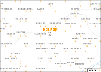
Ḩalbān (Ḩamāh, Syria)Ḩalbān is a town in the Ḩamāh region of Syria. An overview map of the region around Ḩalbān is displayed below.
regional and 3d topo map of Ḩalbān, Syria ::
Ḩalbān airports ::
The nearest airport is LTK - Latakia Bassel Al Assad Intl, located 97.4 km west of Ḩalbān.
Other airports nearby include ALP - Aleppo Intl (107.1 km north), PMS - Palmyra (141.8 km south east), GZT - Gaziantep Oguzeli (195.0 km north), DAM - Damascus Intl (207.1 km south), Nearby towns ::
Al ‘Anz (2.4km north east) //
Al Bardūnah (3.0km west) //
Tall adh Dhahab (4.0km south) //
Ţūbā (4.0km north) //
Abū al Qudūr (4.0km north) //
Khaybah (4.8km south west) //
Umm Qalaq (4.8km north west) //
Ash Shaykh ‘Alī Kāsūn (5.8km south) //
Umm Turaykīyah al Qiblīyah (4.9km east) //
Tamak (7.6km south) //
Nawá (7.2km south east) //
Kharsān (7.2km north east) //
Raʼs al Ḩamrāʼ (7.1km north east) //
[all distances 'as the bird flies' and approximate]  Places with similar names to Ḩalbān, Syria ::
Disclaimer :: Information on this page comes without warranty of any kind |
||
|
Where is Ḩalbān? Elevation and coordinates ::
Latitude (lat): 35°14'0"N Longitude (lon): 37°0'0"E
Elevation (approx.): 533m (map arrows pan, magnifying glasses zoom) |
||
|
Visiting Ḩalbān? Hotel/Accommodation ::
Book a hotel in Ḩalbān Travel Guide ::
Buy a travel guide for Syria rental cars ::
car rental offers GPS waypoint ::
download a GPX waypoint (PoI) of Ḩalbān for your GPS receiver
|
||