|
search place name
|
||
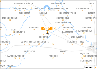
Ash Shīr (Ḩamāh, Syria)Ash Shīr is a town in the Ḩamāh region of Syria. An overview map of the region around Ash Shīr is displayed below.
regional and 3d topo map of Ash Shīr, Syria ::
Ash Shīr airports ::
The nearest airport is LTK - Latakia Bassel Al Assad Intl, located 64.0 km west of Ash Shīr.
Other airports nearby include ALP - Aleppo Intl (124.3 km north east), PMS - Palmyra (171.6 km south east), BEY - Beirut Rafic Hariri Intl (182.4 km south west), DAM - Damascus Intl (196.8 km south), Nearby towns ::
Al Majdal (1.5km west) //
Kafr ‘Amīn (2.4km south west) //
Kafr at Tūn (4.0km south) //
Tall Sikkîne Sâroûte (4.8km south west) //
Zawr al Ḩāmiḑ (4.9km east) //
Ma‘arr Zāf (4.9km west) //
Zawr an Nāşirīyah (5.9km north east) //
Al Jirābīyāt (6.1km east) //
Zawr al Jadīd (6.3km east) //
Khaţţāb (6.3km east) //
Muḩradah (7.6km north) //
Zawr Abū Zayd (7.2km north east) //
At Tuwaym (7.1km south west) //
At Tīzīn (8.7km south east) //
Matnīn (8.7km south east) //
Umm aţ Ţuyūr (9.6km south west) //
Kufūr aţ Ţayyibah (9.6km north east) //
[all distances 'as the bird flies' and approximate] 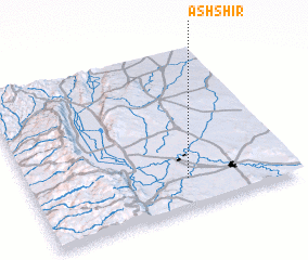 Places with similar names to Ash Shīr, Syria ::
// Ash Shūrah (IQ)
// Ash Shūrá (EG)
// Achichere (GH)
// Ash Shāghūr (JO)
// Ash Shārah (SY)
// Ash Shīr (SY)
// Ash Shawr (OM)
// Ash Sha‘rah (SY)
// Ash Sharī‘ā (SY)
// Ash Shu‘arāʼ (EG)
Disclaimer :: Information on this page comes without warranty of any kind |
||
|
Where is Ash Shīr? Elevation and coordinates ::
Latitude (lat): 35°11'0"N Longitude (lon): 36°36'0"E
Elevation (approx.): 277m (map arrows pan, magnifying glasses zoom) |
||
|
Visiting Ash Shīr? Hotel/Accommodation ::
Book a hotel in Ash Shīr Travel Guide ::
Buy a travel guide for Syria rental cars ::
car rental offers GPS waypoint ::
download a GPX waypoint (PoI) of Ash Shīr for your GPS receiver
|
||