|
search place name
|
||
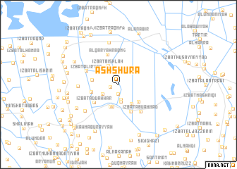
Ash Shūrá (Kafr ash Shaykh, Egypt)Ash Shūrá is a town in the Kafr ash Shaykh region of Egypt. An overview map of the region around Ash Shūrá is displayed below.
regional and 3d topo map of Ash Shūrá, Egypt ::
Ash Shūrá airports ::
The nearest airport is ALY - Alexandria Intl, located 101.7 km west of Ash Shūrá.
Other airports nearby include PSD - Port Said (117.3 km east), CAI - Cairo Intl (135.9 km south), Nearby towns ::
Abū Jāyid (0.9km north) //
‘Izbat ash Sharikah (1.2km south west) //
Al Waqf (1.5km south) //
Az Zajam (2.5km south) //
Ghālib (2.8km south) //
Al ‘Abbāsīyah (2.6km south west) //
Qaryat Ţābā al Jadīdah (2.8km north east) //
‘Izbat Bishlah (3.2km north west) //
Umm Sinn (3.6km south) //
‘Izbat Umm Sinn al Fawqānīyah (3.7km south) //
Az Zāwiyah (3.6km south east) //
‘Izbat Dūmah Maḩmūd Yūnis (3.6km west) //
‘Izbat‘Abd al Wahhāb Muşţafá (3.9km south east) //
‘Izbat ‘Uthmān Bayūmī (3.8km west) //
Kūbrī az Zāwīyah (4.7km south) //
‘Izbat ad Dawwār (4.4km south west) //
Al Qaryah Raqm 6 (4.9km north) //
‘Izbat al ‘Iryān (4.7km north west) //
‘Izbat Abū Aḩmad (5.3km south east) //
‘Izbat al Ḩaşafah (5.4km west) //
‘Izbat ad Daramallī Qaryah 3 (6.7km north) //
Qaryat ar Raghāmah (6.2km south west) //
‘Izbat Bilāl (6.8km south west) //
‘Izbat Mukhayzin (6.9km north west) //
‘Izbat Sa‘d Abū ‘Alī (7.1km west) //
‘Izbat ar Raşīf (7.1km west) //
‘Izbat Muḩammad Abū as Sayyid (7.1km west) //
‘Izbat Raqm 50 (8.3km north) //
Kawm Abū Rayyah (8.1km south west) //
[all distances 'as the bird flies' and approximate] 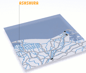 Places with similar names to Ash Shūrá, Egypt ::
// Ash Shūrah (IQ)
// Achichere (GH)
// Ash Shāghūr (JO)
// Ash Shārah (SY)
// Ash Shīr (SY)
// Ash Shīr (SY)
// Ash Shawr (OM)
// Ash Sha‘rah (SY)
// Ash Sharī‘ā (SY)
// Ash Shu‘arāʼ (EG)
Disclaimer :: Information on this page comes without warranty of any kind |
||
|
Where is Ash Shūrá? Elevation and coordinates ::
Latitude (lat): 31°17'55"N Longitude (lon): 31°0'30"E
Elevation (approx.): 3m (map arrows pan, magnifying glasses zoom) |
||
|
Visiting Ash Shūrá? Hotel/Accommodation ::
Book a hotel in Ash Shūrá Travel Guide ::
Buy a travel guide for Egypt rental cars ::
car rental offers GPS waypoint ::
download a GPX waypoint (PoI) of Ash Shūrá for your GPS receiver
|
||