|
search place name
|
||
Dīmū (Ḩamāh, Syria)Dīmū is a town in the Ḩamāh region of Syria. An overview map of the region around Dīmū is displayed below.
regional and 3d topo map of Dīmū, Syria ::

Dīmū airports ::
The nearest airport is LTK - Latakia Bassel Al Assad Intl, located 49.4 km north west of Dīmū.
Other airports nearby include ALP - Aleppo Intl (130.3 km north east), BEY - Beirut Rafic Hariri Intl (175.9 km south west), PMS - Palmyra (186.4 km east), DAM - Damascus Intl (198.6 km south), Nearby towns ::
Jubb Ramlah (1.5km west) //
Ḩanjūr (3.6km south east) //
Aşīlī (4.3km east) //
Tall Sikkīn Qa‘dah (4.8km north east) //
Ma‘arrīn (5.6km south) //
Al Hazzānah (5.8km south) //
Al Aalmîyé (4.9km west) //
‘Uqayribah (5.8km south) //
Al Julaymah (4.9km west) //
Kanfū (4.9km west) //
‘Aqrab (6.0km south) //
Aş Şārimīyah (5.9km north west) //
Al Khān (5.9km south west) //
Mushāshin al Arman (6.1km west) //
Abū Rubayş (6.3km east) //
Al ‘Ashārinah (8.0km north) //
Tall Salḩab (8.2km north west) //
Mashtá al Jawbah (8.2km south west) //
Aş Şafşāfīyah (8.7km north east) //
At Turaymīsah (9.6km north east) //
[all distances 'as the bird flies' and approximate] 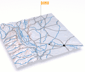 Places with similar names to Dīmū, Syria ::
Disclaimer :: Information on this page comes without warranty of any kind |
||
|
Where is Dīmū? Elevation and coordinates ::
Latitude (lat): 35°12'0"N Longitude (lon): 36°26'0"E
Elevation (approx.): 190m (map arrows pan, magnifying glasses zoom) |
||
|
Visiting Dīmū? Hotel/Accommodation ::
Book a hotel in Dīmū Travel Guide ::
Buy a travel guide for Syria rental cars ::
car rental offers GPS waypoint ::
download a GPX waypoint (PoI) of Dīmū for your GPS receiver
|
||