|
search place name
|
||
Dīwār (Al Ḩasakah, Syria)Dīwār is a town in the Al Ḩasakah region of Syria. An overview map of the region around Dīwār is displayed below.
regional and 3d topo map of Dīwār, Syria ::

Dīwār airports ::
The nearest airport is BAL - Batman, located 119.2 km north west of Dīwār.
Other airports nearby include VAN - Van (165.7 km north east), DIY - Diyabakir Diyarbakir (188.6 km west), Nearby towns ::
Cudiye (2.9km north) //
Mazra‘at Bālah (2.4km east) //
Dayr Yāsīn (3.2km south east) //
Yakacık (3.7km north east) //
Tildār (4.0km south east) //
Çavuş (3.5km west) //
Üzümlü (4.3km north west) //
Kömürlü (4.1km north west) //
Al Jisr (4.8km south) //
Khān Yūnis (5.1km south west) //
Kafes (5.2km north east) //
Rīḩānīk (5.0km south east) //
Cizre (5.7km north) //
Ḩabb al Hawāʼ (5.0km south west) //
Mazra‘at Muslim (4.6km east) //
Al Qādirīyah (5.9km south) //
Mehmedi (4.9km east) //
Sulak (5.3km west) //
Gürsü (5.2km west) //
Yeşilyurt (5.6km north west) //
‘Ayn al Bāz (6.6km south) //
Kasān (6.2km south east) //
Fıstıklı (6.2km north west) //
Kuriş (6.8km north east) //
Kuştepe (7.2km north west) //
Khirbat ‘Ubayd (8.1km south) //
Qaşr ad Dīb (7.4km south west) //
Santarla (6.6km west) //
Çatalköy (7.9km north west) //
[all distances 'as the bird flies' and approximate] 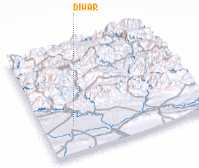 Places with similar names to Dīwār, Syria ::
Disclaimer :: Information on this page comes without warranty of any kind |
||
|
Where is Dīwār? Elevation and coordinates ::
Latitude (lat): 37°16'49"N Longitude (lon): 42°11'31"E
Elevation (approx.): 466m (map arrows pan, magnifying glasses zoom) |
||
|
Visiting Dīwār? Hotel/Accommodation ::
Book a hotel in Dīwār Travel Guide ::
Buy a travel guide for Syria rental cars ::
car rental offers GPS waypoint ::
download a GPX waypoint (PoI) of Dīwār for your GPS receiver
|
||