|
search place name
|
||
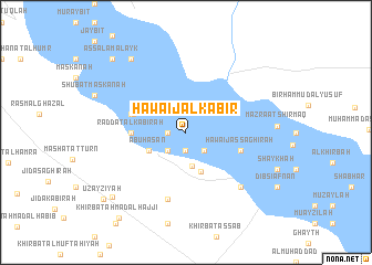
Ḩawāʼij al Kabīr (Ar Raqqah, Syria)Ḩawāʼij al Kabīr is a town in the Ar Raqqah region of Syria. An overview map of the region around Ḩawāʼij al Kabīr is displayed below.
regional and 3d topo map of Ḩawāʼij al Kabīr, Syria ::
Ḩawāʼij al Kabīr airports ::
The nearest airport is ALP - Aleppo Intl, located 89.6 km west of Ḩawāʼij al Kabīr.
Other airports nearby include GZT - Gaziantep Oguzeli (125.8 km north west), PMS - Palmyra (156.8 km south), DEZ - Deire Zor Deir Zzor (195.7 km east), Nearby towns ::
Shanhaşah (1.5km west) //
Fashīk (1.9km south) //
Marqadah (2.4km south west) //
Abū Zurayqīyah (2.4km south east) //
Raddat aş Şaghīr (3.4km south) //
Abū Ḩasan (3.5km south west) //
Fukhaykhā (4.2km south) //
Raddat al Kabīrah (4.5km west) //
Ḩardānah (4.6km north west) //
As Samūmah (4.9km west) //
Ḩawāʼij aş Şaghīrah (4.9km east) //
Musaţţaḩat al Makhrūm (7.0km south) //
Dibsī Faraj (7.2km south east) //
Kasrat Muraybiţ (8.7km north west) //
Khirbat Huwaydat Umm Ḩijārah (8.8km south west) //
As Salām ‘Alayk (9.5km north west) //
‘Uzayzīyah (9.6km south west) //
Khirbat Aḩmad al Ḩajjī (10.3km south west) //
[all distances 'as the bird flies' and approximate]  Places with similar names to Ḩawāʼij al Kabīr, Syria :: Disclaimer :: Information on this page comes without warranty of any kind |
||
|
Where is Ḩawāʼij al Kabīr? Elevation and coordinates ::
Latitude (lat): 35°58'0"N Longitude (lon): 38°11'0"E
Elevation (approx.): 302m (map arrows pan, magnifying glasses zoom) |
||
|
Visiting Ḩawāʼij al Kabīr? Hotel/Accommodation ::
Book a hotel in Ḩawāʼij al Kabīr Travel Guide ::
Buy a travel guide for Syria rental cars ::
car rental offers GPS waypoint ::
download a GPX waypoint (PoI) of Ḩawāʼij al Kabīr for your GPS receiver
|
||