|
search place name
|
||
Hubūb ar Rīḩ (Ḩimş, Syria)Hubūb ar Rīḩ is a town in the Ḩimş region of Syria. An overview map of the region around Hubūb ar Rīḩ is displayed below.
regional and 3d topo map of Hubūb ar Rīḩ, Syria ::

Hubūb ar Rīḩ airports ::
The nearest airport is LTK - Latakia Bassel Al Assad Intl, located 93.4 km north west of Hubūb ar Rīḩ.
Other airports nearby include PMS - Palmyra (153.4 km east), BEY - Beirut Rafic Hariri Intl (153.9 km south west), DAM - Damascus Intl (155.1 km south), ALP - Aleppo Intl (161.0 km north), Nearby towns ::
Al Ḩalamūz (1.6km north) //
Ad Dār al Kabīrah (2.2km south) //
Ţayr Ma‘lah (2.8km east) //
Al Rhannto (2.8km east) //
Al Ghāşibīyah (3.7km south) //
Rām (3.8km south west) //
Mazra‘at Rafqīn (4.2km west) //
Qanāyah (5.5km north) //
Sunaysil (4.8km west) //
Kharkhar (5.9km south) //
Ad Duwayr (6.0km south) //
Akrād Dayāsinah (5.9km north west) //
Umm Sharshūḩ (7.2km north) //
Rafīn (6.3km west) //
Talbīsah (6.7km north east) //
Tasnīn (7.9km north) //
Umm al Qaşşāb (7.6km south west) //
Az Zarzūrīyah (8.3km south west) //
Ḩimş (8.8km south east) //
[all distances 'as the bird flies' and approximate] 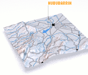 Places with similar names to Hubūb ar Rīḩ, Syria :: Disclaimer :: Information on this page comes without warranty of any kind |
||
|
Where is Hubūb ar Rīḩ? Elevation and coordinates ::
Latitude (lat): 34°48'10"N Longitude (lon): 36°40'10"E
Elevation (approx.): 465m (map arrows pan, magnifying glasses zoom) |
||
|
Visiting Hubūb ar Rīḩ? Hotel/Accommodation ::
Book a hotel in Hubūb ar Rīḩ Travel Guide ::
Buy a travel guide for Syria rental cars ::
car rental offers GPS waypoint ::
download a GPX waypoint (PoI) of Hubūb ar Rīḩ for your GPS receiver
|
||