|
search place name
|
||
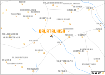
Qal‘at al Ḩişn (Al Ḩasakah, Syria)Qal‘at al Ḩişn is a town in the Al Ḩasakah region of Syria. An overview map of the region around Qal‘at al Ḩişn is displayed below.
regional and 3d topo map of Qal‘at al Ḩişn, Syria ::
Qal‘at al Ḩişn airports ::
The nearest airport is BAL - Batman, located 145.4 km north west of Qal‘at al Ḩişn.
Other airports nearby include VAN - Van (191.0 km north east), Nearby towns ::
Tall Khinzīr Taḩtānī (2.5km north west) //
Kalhī (3.3km south east) //
Ḩammāmuk (3.6km north west) //
Tall Khinzīr Fawqānī (3.7km north west) //
Māsikah (4.7km east) //
‘Ayn ‘Arnah (5.2km north east) //
Al Walīd (6.0km south west) //
Umm at Tulūl (6.4km north) //
Quldmān (5.6km west) //
Kaff al Aswad (6.5km north east) //
Al Walīd (6.6km south west) //
‘Ayn ‘Akfat al Ma‘lajī (7.0km north east) //
Al Batrāʼ (9.7km north west) //
Al Ḩammām (9.7km north west) //
[all distances 'as the bird flies' and approximate] 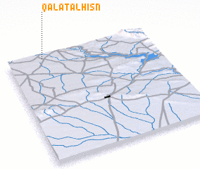 Places with similar names to Qal‘at al Ḩişn, Syria ::
// Qal‘at al Ḩişn (SY)
// Qal‘at al Ḩişn (SY)
Disclaimer :: Information on this page comes without warranty of any kind |
||
|
Where is Qal‘at al Ḩişn? Elevation and coordinates ::
Latitude (lat): 36°58'44"N Longitude (lon): 42°14'52"E
Elevation (approx.): 439m (map arrows pan, magnifying glasses zoom) |
||
|
Visiting Qal‘at al Ḩişn? Hotel/Accommodation ::
Book a hotel in Qal‘at al Ḩişn Travel Guide ::
Buy a travel guide for Syria rental cars ::
car rental offers GPS waypoint ::
download a GPX waypoint (PoI) of Qal‘at al Ḩişn for your GPS receiver
|
||