|
search place name
|
||
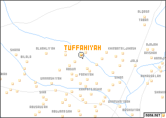
Tuffāḩīyah (Al Ḩasakah, Syria)Tuffāḩīyah is a town in the Al Ḩasakah region of Syria. An overview map of the region around Tuffāḩīyah is displayed below.
regional and 3d topo map of Tuffāḩīyah, Syria ::
Tuffāḩīyah airports ::
The nearest airport is DEZ - Deire Zor Deir Zzor, located 112.5 km south of Tuffāḩīyah.
Other airports nearby include DIY - Diyabakir Diyarbakir (188.4 km north), BAL - Batman (193.5 km north), Nearby towns ::
Tall al Laḩm (1.6km north) //
Umm Ḩijārah (1.6km west) //
Mutawassiţah (2.3km south) //
Zaraf (3.0km south east) //
Quşaybah (2.8km south east) //
Bāb al Faraj (2.9km south west) //
Umm Ḩafūr (3.9km south) //
Sahlat ad Dubbān (3.4km west) //
‘Abdūn (3.9km south west) //
Ţalī‘ah (3.5km east) //
Musayjirah (3.7km north west) //
Farḩīyah (4.7km south) //
Finlah (5.0km south west) //
RujmatḨabs (4.5km east) //
Khirbat al Ghadīr (5.6km south) //
Khirbat as Suwaydīyah (4.9km south west) //
Al Fakkā (6.2km south) //
Şāliḩīyah (6.1km south east) //
Rujm Kabbās (6.0km east) //
Qārrat al Ḩajjīyah (6.3km south east) //
Khirbat as Sawdā (7.7km south) //
Kahfāt Şaghīr (8.2km south) //
Al Ḩulw (8.4km south) //
Al Waḩlīyah (6.8km west) //
Ḩamdānīyah (6.9km east) //
Fallīnah (8.6km south) //
Sīḩā (8.0km south east) //
Umm Ma‘shīyah (8.0km south west) //
Shīḩān (8.5km south east) //
[all distances 'as the bird flies' and approximate]  Places with similar names to Tuffāḩīyah, Syria ::
// Tuffāḩīyah (SY)
Disclaimer :: Information on this page comes without warranty of any kind |
||
|
Where is Tuffāḩīyah? Elevation and coordinates ::
Latitude (lat): 36°13'50"N Longitude (lon): 40°37'30"E
Elevation (approx.): 308m (map arrows pan, magnifying glasses zoom) |
||
|
Visiting Tuffāḩīyah? Hotel/Accommodation ::
Book a hotel in Tuffāḩīyah Travel Guide ::
Buy a travel guide for Syria rental cars ::
car rental offers GPS waypoint ::
download a GPX waypoint (PoI) of Tuffāḩīyah for your GPS receiver
|
||