|
search place name
|
||
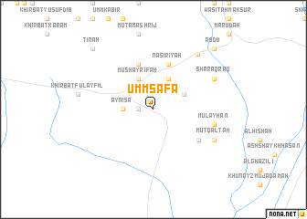
Umm Şafāʼ (Ar Raqqah, Syria)Umm Şafāʼ is a town in the Ar Raqqah region of Syria. An overview map of the region around Umm Şafāʼ is displayed below.
regional and 3d topo map of Umm Şafāʼ, Syria ::
Umm Şafāʼ airports ::
The nearest airport is GZT - Gaziantep Oguzeli, located 142.5 km north west of Umm Şafāʼ.
Other airports nearby include ALP - Aleppo Intl (152.0 km west), DEZ - Deire Zor Deir Zzor (166.4 km south east), DIY - Diyabakir Diyarbakir (205.2 km north east), PMS - Palmyra (207.6 km south), Nearby towns ::
Jūrah (1.5km west) //
‘Ayn ‘Īsá (3.0km west) //
Mutamashrij (3.5km north east) //
Khirbat Sārandah (4.0km north) //
Mushayrifah (4.0km north) //
Khāfīyah (5.8km north) //
Nāşirīyah (5.8km north) //
Al Adrīyah (5.8km south east) //
Mulayḩān (6.3km east) //
Fāţisah (7.0km north east) //
Sharaqraq (7.0km north east) //
Kalţah (7.0km south east) //
Mutqaltah (7.0km south east) //
Kharījah (8.0km north east) //
‘Abdū (9.5km north east) //
Tīnah (9.5km north west) //
Shuwayḩān (9.5km north east) //
[all distances 'as the bird flies' and approximate] 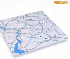 Places with similar names to Umm Şafāʼ, Syria ::
// Umm aş Şafā (SY)
// Umm aş Şūf (QA)
Disclaimer :: Information on this page comes without warranty of any kind |
||
|
Where is Umm Şafāʼ? Elevation and coordinates ::
Latitude (lat): 36°22'0"N Longitude (lon): 38°54'0"E
Elevation (approx.): 323m (map arrows pan, magnifying glasses zoom) |
||
|
Visiting Umm Şafāʼ? Hotel/Accommodation ::
Book a hotel in Umm Şafāʼ Travel Guide ::
Buy a travel guide for Syria rental cars ::
car rental offers GPS waypoint ::
download a GPX waypoint (PoI) of Umm Şafāʼ for your GPS receiver
|
||