|
search place name
|
||
Umm aş Şūf (Madīnat ash Shamāl, Qatar)Umm aş Şūf is a town in the Madīnat ash Shamāl region of Qatar. An overview map of the region around Umm aş Şūf is displayed below.
regional and 3d topo map of Umm aş Şūf, Qatar ::

Umm aş Şūf airports ::
The nearest airport is BAH - Bahrain Intl, located 62.6 km west of Umm aş Şūf.
Other airports nearby include DOH - Doha Intl (96.7 km south), DHA - Dhahran King Abdulaziz Ab (109.0 km west), DMM - Dammam King Fahd Intl (148.8 km west), LEA - Al-ahsa Al Ahsa (195.2 km south west), Nearby towns ::
Al Qa‘ābīyah (3.8km east) //
Zaghāb (4.1km north east) //
Al Ka‘bīyah (4.1km south east) //
Madīnat ash Shamāl (4.4km north) //
Al Wa‘b (5.2km north) //
Umm al Kilāb (5.3km south west) //
‘Aşmīyah (5.5km west) //
Ar Ruʼays (6.3km north) //
Al Jumayl (6.6km west) //
Abū az̧ Z̧ulūf (7.4km north west) //
As Sidrīyah (7.4km south west) //
Sidrīyat Makīn (7.6km south west) //
Ar Ruwayḑah (7.5km west) //
Umm al Ḩawāʼir (8.1km east) //
Al Mafjar (10.0km north east) //
Umm al Ghayl am (11.2km south east) //
[all distances 'as the bird flies' and approximate] 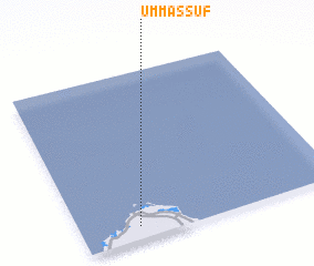 Places with similar names to Umm aş Şūf, Qatar ::
// Umm aş Şafā (SY)
// Umm Şafāʼ (SY)
Disclaimer :: Information on this page comes without warranty of any kind |
||
|
Where is Umm aş Şūf? Elevation and coordinates ::
Latitude (lat): 26°4'38"N Longitude (lon): 51°13'20"E
Elevation (approx.): 13m (map arrows pan, magnifying glasses zoom) |
||
|
Visiting Umm aş Şūf? Hotel/Accommodation ::
Book a hotel in Umm aş Şūf Travel Guide ::
Buy a travel guide for Qatar rental cars ::
car rental offers GPS waypoint ::
download a GPX waypoint (PoI) of Umm aş Şūf for your GPS receiver
|
||