|
search place name
|
||
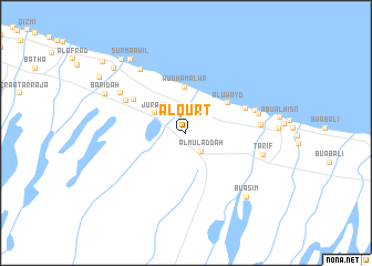
Al Qurţ (Oman)Al Qurţ is a town in Oman. An overview map of the region around Al Qurţ is displayed below.
regional and 3d topo map of Al Qurţ, Oman ::
Al Qurţ airports ::
The nearest airport is MCT - Muscat Seeb Intl, located 77.3 km east of Al Qurţ.
Other airports nearby include FJR - Fujeirah Fujairah Intl (194.1 km north west), RKT - Ras Al Khaimah Intl (261.6 km north west), Nearby towns ::
Al Muladdah (2.4km south east) //
Bulayţah (3.0km north west) //
Jurayd (3.5km north west) //
Wudhām ‘Alwāʼ (4.6km north) //
Al ‘Uwayd (4.9km north east) //
Tharmad (5.9km north west) //
Shirş Yāl Burayk (6.1km north east) //
Ḩamīzah (6.4km north west) //
Ash Shirş (6.8km east) //
Juraym (7.0km east) //
Wādī Shirş (7.0km east) //
Al Musayḩ (7.3km north west) //
Badī‘at ‘Ūd (7.7km north west) //
Ţarīf (7.5km east) //
Bū ‘Āşim (8.5km south east) //
Baridah (8.4km north west) //
Khabbah (9.0km north west) //
Sūr Ma‘āwil (9.0km north west) //
Al Ghū (9.3km north west) //
Buday‘ah (9.5km north west) //
Ţubbah (9.7km north west) //
Al Bid‘ah (10.5km north west) //
[all distances 'as the bird flies' and approximate] 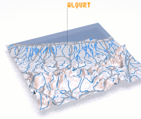 Places with similar names to Al Qurţ, Oman ::
Disclaimer :: Information on this page comes without warranty of any kind |
||
|
Where is Al Qurţ? Elevation and coordinates ::
Latitude (lat): 23°46'0"N Longitude (lon): 57°33'0"E
Elevation (approx.): 9m (map arrows pan, magnifying glasses zoom) |
||
|
Visiting Al Qurţ? Hotel/Accommodation ::
Book a hotel in Al Qurţ Travel Guide ::
Buy a travel guide for Oman rental cars ::
car rental offers GPS waypoint ::
download a GPX waypoint (PoI) of Al Qurţ for your GPS receiver
|
||