|
search place name
|
||
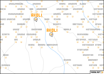
Akoli (Gongola, Nigeria)Akoli is a town in the Gongola region of Nigeria. An overview map of the region around Akoli is displayed below.
regional and 3d topo map of Akoli, Nigeria ::
Akoli airports ::
The nearest airport is PHC - Port Hartcourt Port Harcourt Intl, located 53.7 km west of Akoli.
Other airports nearby include CBQ - Calabar (101.5 km east), ENU - Enugu (160.0 km north), SSG - Malabo (200.0 km south east), TKC - Tiko (238.0 km south east), Nearby towns ::
Agburu Uke (1.9km north) //
Umuomayi (1.9km north) //
Aba Nkomini (3.7km south) //
Oku Enyi (4.1km north east) //
Ama Apu (5.2km south west) //
Abayi Nchokoro (5.5km west) //
Ovom (5.9km north) //
Umu Aja (5.8km west) //
Aba Ala (5.8km east) //
Owerri Aba (5.8km west) //
Nchina (5.9km north) //
Osusu Aku (7.4km west) //
Ntigha (7.4km north) //
Abayi (7.4km north) //
Ukpakiri (7.4km north) //
Umuoru (7.6km north) //
Akoli (7.8km north west) //
Akanu (8.3km south west) //
Ehere (8.3km north west) //
Ndi Eguru (9.3km north west) //
Umu Dosi (9.3km north east) //
Umu Echi (9.3km north east) //
Oke Enyi (10.5km north east) //
[all distances 'as the bird flies' and approximate] 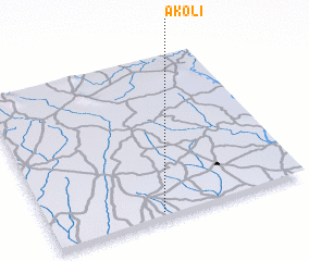 Places with similar names to Akoli, Nigeria ::
Disclaimer :: Information on this page comes without warranty of any kind |
||
|
Where is Akoli? Elevation and coordinates ::
Latitude (lat): 5°2'0"N Longitude (lon): 7°26'0"E
Elevation (approx.): 59m (map arrows pan, magnifying glasses zoom) |
||
|
Visiting Akoli? Hotel/Accommodation ::
Book a hotel in Akoli Travel Guide ::
Buy a travel guide for Nigeria rental cars ::
car rental offers GPS waypoint ::
download a GPX waypoint (PoI) of Akoli for your GPS receiver
|
||