|
search place name
|
||
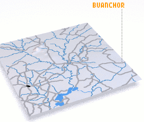
Buanchor (Gongola, Nigeria)Buanchor is a town in the Gongola region of Nigeria. An overview map of the region around Buanchor is displayed below.
regional and 3d topo map of Buanchor, Nigeria ::

Buanchor airports ::
The nearest airport is BPC - Bamenda, located 130.2 km east of Buanchor.
Other airports nearby include MDI - Makurdi (157.0 km north), ENU - Enugu (158.0 km west), CBQ - Calabar (165.8 km south west), BFX - Bafoussam (175.5 km south east), Nearby towns ::
 Places with similar names to Buanchor, Nigeria ::
// Bānī Shār (IQ)
// Ban Chao Rai (TH)
// Ban Chari (TH)
// Ban O Charao (TH)
// Bon Shahrī (IR)
// Banchhor (IN)
// Banachari (MX)
// Bin Ghashīr (LY)
// Ban Chéra (LA)
// Ben Cherrou (MA)
Disclaimer :: Information on this page comes without warranty of any kind |
||
|
Where is Buanchor? Elevation and coordinates ::
Latitude (lat): 6°20'0"N Longitude (lon): 8°59'0"E
Elevation (approx.): 863m (map arrows pan, magnifying glasses zoom) |
||
|
Visiting Buanchor? Hotel/Accommodation ::
Book a hotel in Buanchor Travel Guide ::
Buy a travel guide for Nigeria rental cars ::
car rental offers GPS waypoint ::
download a GPX waypoint (PoI) of Buanchor for your GPS receiver
|
||