|
search place name
|
||
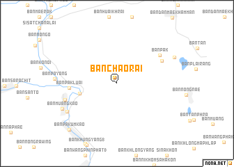
Ban Chao Rai (Sukhothai, Thailand)Ban Chao Rai is a town in the Sukhothai region of Thailand. An overview map of the region around Ban Chao Rai is displayed below.
regional and 3d topo map of Ban Chao Rai, Thailand ::
Ban Chao Rai airports ::
The nearest airport is PRH - Phrae, located 82.7 km north of Ban Chao Rai.
Other airports nearby include PHS - Phitsanulok (84.0 km south east), LPT - Lampang (100.5 km north west), LOE - Loei (195.8 km east), Nearby towns ::
Ban Mon Sung (6.0km west) //
Ban Pa Kluai (7.3km west) //
Ban Rai (7.8km north east) //
Ban Pak (8.0km north east) //
Ban Nong Chang (8.4km west) //
Ban Tha Chai (8.8km south west) //
Ban Muang Kao (9.3km south west) //
Ban Pa Kum Kao (10.4km south west) //
[all distances 'as the bird flies' and approximate]  Places with similar names to Ban Chao Rai, Thailand ::
// Bānī Shār (IQ)
// Ban Chari (TH)
// Ban O Charao (TH)
// Bon Shahrī (IR)
// Banchhor (IN)
// Banachari (MX)
// Bin Ghashīr (LY)
// Buanchor (NG)
// Ban Chéra (LA)
// Ben Cherrou (MA)
Disclaimer :: Information on this page comes without warranty of any kind |
||
|
Where is Ban Chao Rai? Elevation and coordinates ::
Latitude (lat): 17°26'13"N Longitude (lon): 99°52'43"E
Elevation (approx.): 64m (map arrows pan, magnifying glasses zoom) |
||
|
Visiting Ban Chao Rai? Hotel/Accommodation ::
Book a hotel in Ban Chao Rai Travel Guide ::
Buy a travel guide for Thailand rental cars ::
car rental offers GPS waypoint ::
download a GPX waypoint (PoI) of Ban Chao Rai for your GPS receiver
|
||