|
search place name
|
||
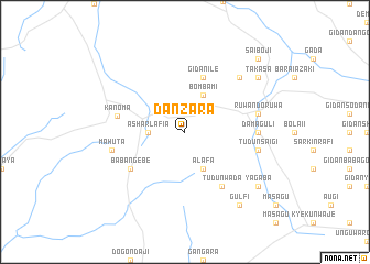
Dan Zara (Gongola, Nigeria)Dan Zara is a town in the Gongola region of Nigeria. An overview map of the region around Dan Zara is displayed below.
regional and 3d topo map of Dan Zara, Nigeria ::
Dan Zara airports ::
The nearest airport is QUS - Gusau, located 36.2 km east of Dan Zara.
Other airports nearby include SKO - Sokoto Sadiq Abubakar Iii Intl (147.9 km north west), MFG - Maradi (164.4 km north east), ZAR - Zaria (187.4 km south east), KAD - Kaduna (197.8 km south east), Nearby towns ::
Ashar Lafia (3.6km west) //
Bom Bami (4.1km north east) //
Alafa (4.1km south east) //
Gidan Ile (5.8km north) //
Margau (6.6km south east) //
Tudun Wada (6.6km south east) //
Baban Gebe (6.6km south west) //
Kanoma (6.9km west) //
Dama Guli (7.2km east) //
Ruwan Doruwa (7.5km east) //
Tudun Saigi (7.5km east) //
Mahuta (7.5km west) //
Kade Daba (7.8km north east) //
Yagaba (9.1km south east) //
Takasa (9.1km north east) //
Gulfi (9.2km south east) //
Saiboji (10.4km north east) //
[all distances 'as the bird flies' and approximate] 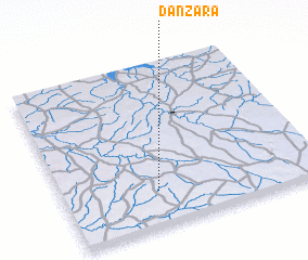 Places with similar names to Dan Zara, Nigeria ::
// Tanessar (MA)
// Da-an Sur (PH)
// Dinosaur (US)
// Duna Sor (HU)
// Tõnissaare (EE)
// Danışır (TR)
// Dansür (TR)
// Dansar (IR)
// Deh Naz̄rī (IR)
// Dīneh Sar (IR)
Disclaimer :: Information on this page comes without warranty of any kind |
||
|
Where is Dan Zara? Elevation and coordinates ::
Latitude (lat): 12°13'0"N Longitude (lon): 6°22'0"E
Elevation (approx.): 450m (map arrows pan, magnifying glasses zoom) |
||
|
Visiting Dan Zara? Hotel/Accommodation ::
Book a hotel in Dan Zara Travel Guide ::
Buy a travel guide for Nigeria rental cars ::
car rental offers GPS waypoint ::
download a GPX waypoint (PoI) of Dan Zara for your GPS receiver
|
||