|
search place name
|
||
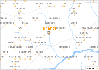
Dederi (Gongola, Nigeria)Dederi is a town in the Gongola region of Nigeria. An overview map of the region around Dederi is displayed below.
regional and 3d topo map of Dederi, Nigeria ::
Dederi airports ::
The nearest airport is KAN - Kano Mallam Aminu Intl, located 56.1 km north east of Dederi.
Other airports nearby include ZAR - Zaria (89.0 km south west), KAD - Kaduna (150.5 km south west), QUS - Gusau (151.7 km west), MFG - Maradi (208.5 km north west), Nearby towns ::
Sabon Birni (1.8km west) //
Kutumburi (3.7km north) //
Dan Madadi (3.7km north) //
Unguwan Dabai (4.1km north east) //
Zangon (4.1km south west) //
Tunfafi (4.1km south west) //
Unguwan Kwari (5.2km south west) //
Yan Guruza (5.8km north) //
Dadarau (6.6km north west) //
Dan Kada (7.5km west) //
Kogin Dabga (7.8km south east) //
Zango (7.8km north west) //
Karaye (8.3km south west) //
Jamaa Kosa (9.2km south west) //
Kadafa (9.1km south west) //
[all distances 'as the bird flies' and approximate] 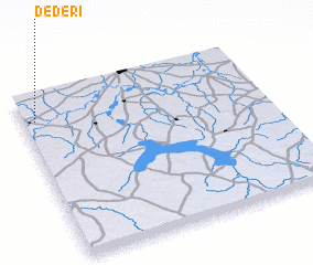 Places with similar names to Dederi, Nigeria ::
Disclaimer :: Information on this page comes without warranty of any kind |
||
|
Where is Dederi? Elevation and coordinates ::
Latitude (lat): 11°51'0"N Longitude (lon): 8°3'0"E
Elevation (approx.): 515m (map arrows pan, magnifying glasses zoom) |
||
|
Visiting Dederi? Hotel/Accommodation ::
Book a hotel in Dederi Travel Guide ::
Buy a travel guide for Nigeria rental cars ::
car rental offers GPS waypoint ::
download a GPX waypoint (PoI) of Dederi for your GPS receiver
|
||