|
search place name
|
||
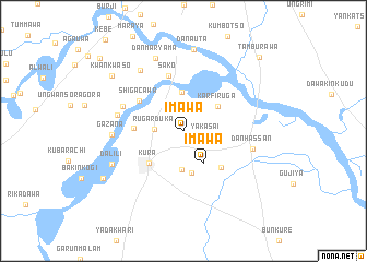
Imawa (Kano, Nigeria)Imawa is a town in the Kano region of Nigeria. An overview map of the region around Imawa is displayed below.
regional and 3d topo map of Imawa, Nigeria ::
Imawa airports ::
The nearest airport is KAN - Kano Mallam Aminu Intl, located 28.1 km north of Imawa.
Other airports nearby include ZAR - Zaria (112.6 km south west), KAD - Kaduna (174.6 km south west), QUS - Gusau (196.6 km west), ZND - Zinder (226.0 km north), Nearby towns ::
Yakasai (2.4km east) //
Rugar Duka (2.9km west) //
Imawa (3.9km south east) //
Bawa (4.0km north) //
Sadauki (4.0km south) //
Karfi Ruga (4.3km north east) //
Kosawa (4.4km south) //
Kura (4.8km south west) //
Butauwa (4.9km west) //
Garun Kaya (5.3km south east) //
Shigacawa (5.4km north west) //
Sako (5.9km north) //
Ningawa (6.6km north west) //
Kundurum (6.8km west) //
Dan Hassan (7.1km east) //
Gazana (7.1km west) //
Kanwa (7.6km north west) //
Dan Maryama (8.0km north) //
Dalili (7.9km south west) //
Dan Auta (8.4km north) //
Kwankwaso (9.2km north west) //
Alore (9.4km south west) //
Tamburawa (10.7km north east) //
Galadimawa (11.1km north west) //
[all distances 'as the bird flies' and approximate] 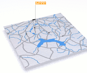 Places with similar names to Imawa, Nigeria ::
Disclaimer :: Information on this page comes without warranty of any kind |
||
|
Where is Imawa? Elevation and coordinates ::
Latitude (lat): 11°48'5"N Longitude (lon): 8°27'42"E
Elevation (approx.): 458m (map arrows pan, magnifying glasses zoom) |
||
|
Visiting Imawa? Hotel/Accommodation ::
Book a hotel in Imawa Travel Guide ::
Buy a travel guide for Nigeria rental cars ::
car rental offers GPS waypoint ::
download a GPX waypoint (PoI) of Imawa for your GPS receiver
|
||