|
search place name
|
||
Imbwae (Western, Zambia)Imbwae is a town in the Western region of Zambia. An overview map of the region around Imbwae is displayed below.
regional and 3d topo map of Imbwae, Zambia ::
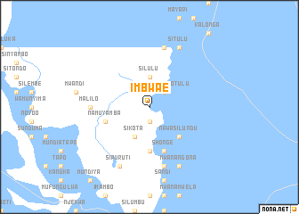
Nearby towns ::
Analiwa (1.9km south) //
Kakanda (1.9km south) //
Kanda (1.9km south) //
Nangulwe Notulu (2.6km north east) //
Imasikwana (2.6km north east) //
Silulu (3.7km north) //
Sikota (4.1km south west) //
Ibukwe (5.2km south east) //
Nawasilundu (5.2km south east) //
Pulu (5.6km south) //
Namuyamba (5.7km west) //
Shonge (5.8km south) //
Lingomba (5.8km south) //
Malilo (7.2km west) //
Makono (7.6km south) //
Simbunda (7.6km north) //
Lamukwena (7.6km north) //
Sipuruti (8.2km south west) //
Mwanangona (8.2km south east) //
Situlu (8.2km north east) //
[all distances 'as the bird flies' and approximate] 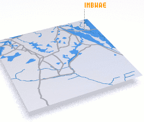 Places with similar names to Imbwae, Zambia ::
Disclaimer :: Information on this page comes without warranty of any kind |
||
|
Where is Imbwae? Elevation and coordinates ::
Latitude (lat): 15°4'0"S Longitude (lon): 22°56'0"E
Elevation (approx.): 1019m (map arrows pan, magnifying glasses zoom) |
||
|
Visiting Imbwae? Hotel/Accommodation ::
Book a hotel in Imbwae Travel Guide ::
Buy a travel guide for Zambia rental cars ::
car rental offers GPS waypoint ::
download a GPX waypoint (PoI) of Imbwae for your GPS receiver
|
||