|
search place name
|
||
Jauro Amadu (Gongola, Nigeria)Jauro Amadu is a town in the Gongola region of Nigeria. An overview map of the region around Jauro Amadu is displayed below.
regional and 3d topo map of Jauro Amadu, Nigeria ::

Jauro Amadu airports ::
The nearest airport is YOL - Yola, located 76.9 km north of Jauro Amadu.
Other airports nearby include GOU - Garoua (140.8 km north east), NGE - N'gaoundere Ngaoundere (188.9 km south east), MVR - Maroua Salak (295.5 km north east), Nearby towns ::
Dalahi (2.6km north east) //
Mapidi (2.6km south west) //
Wuro Jato (3.7km north) //
Bayami (3.7km north) //
Sentare (3.7km west) //
Kojoli (4.1km north east) //
Sankemi (4.1km north west) //
Wuro Lawal (4.1km south east) //
Garga Baba (4.1km south east) //
Garwura (4.1km south west) //
Gaje (5.2km north west) //
Bello Barkwasa (5.2km south east) //
Gajere (5.5km west) //
Kwasa (5.6km south) //
Timyama (5.8km west) //
Dabeki (5.8km west) //
Batel (5.8km east) //
Sentare (5.8km west) //
Barde (5.9km north) //
Jida (5.9km north) //
Wajiri Sama (5.9km south) //
Shamaki (6.7km north west) //
Jupa (6.6km north west) //
Boro (6.7km north east) //
Gajo (6.7km south east) //
Duka (6.6km south west) //
Nyagan (6.6km south east) //
Leyi (7.3km west) //
Dabeki (7.3km west) //
[all distances 'as the bird flies' and approximate] 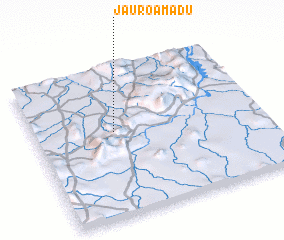 Places with similar names to Jauro Amadu, Nigeria ::
// Germete (DE)
// Giarmata (RO)
// Germade (ES)
// Germeade (ES)
// Jarmet (ET)
// Jaramito (VE)
// Jirmātī (SY)
// Jauro Amadu (NG)
// Jaramatáia (BR)
// Jaramtai (CN)
Disclaimer :: Information on this page comes without warranty of any kind |
||
|
Where is Jauro Amadu? Elevation and coordinates ::
Latitude (lat): 8°34'0"N Longitude (lon): 12°21'0"E
Elevation (approx.): 427m (map arrows pan, magnifying glasses zoom) |
||
|
Visiting Jauro Amadu? Hotel/Accommodation ::
Book a hotel in Jauro Amadu Travel Guide ::
Buy a travel guide for Nigeria rental cars ::
car rental offers GPS waypoint ::
download a GPX waypoint (PoI) of Jauro Amadu for your GPS receiver
|
||