|
search place name
|
||
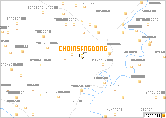
Chŏinsang-dong (P'yŏngan, Korea, North)Chŏinsang-dong is a town in the P'yŏngan region of Korea, North. An overview map of the region around Chŏinsang-dong is displayed below.
regional and 3d topo map of Chŏinsang-dong, Korea, North ::
Chŏinsang-dong airports ::
The nearest airport is FNJ - Pyongyang Intl, located 82.3 km south of Chŏinsang-dong.
Nearby towns ::
Chein-ni (0.5km north) //
Yangch'am (2.2km north west) //
Yonghŭng-ni (3.1km west) //
Ipsŏkha-dong (3.7km east) //
Songjŏng-dong (5.8km north) //
Kuŭm-ni (4.8km east) //
Ŭngbong-ni (6.6km north east) //
Yongsŏng-ni (7.2km south) //
Chŏnsŭng-ni (6.5km south east) //
Kan-dong (6.0km north east) //
Choyang-ni (6.0km north east) //
Myŏngdang-dong (6.0km west) //
Kadŏk-tong (7.8km north) //
Myŏngam (8.0km north) //
Kyeyang-dong (8.0km north) //
Yongyŏn-dong (6.6km north west) //
Unsŏng-dong (8.7km north) //
Yongjŏn-dong (8.4km north) //
Hach'o-ri (8.9km south east) //
Sangjoyang-dong (9.6km south west) //
Sŏndol (10.0km south east) //
[all distances 'as the bird flies' and approximate] 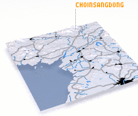 Places with similar names to Chŏinsang-dong, Korea, North ::
// Chinsang-dong (KP)
// Ch'ŏnsang-dong (KP)
// Ch'ŏnsŏng-dong (KP)
// Chŏnsŭng-dong (KP)
// Ch'ŏnsŏng-dong (KR)
// Ch'ŏnsang-dong (KP)
Disclaimer :: Information on this page comes without warranty of any kind |
||
|
Where is Chŏinsang-dong? Elevation and coordinates ::
Latitude (lat): 39°57'45"N Longitude (lon): 125°45'6"E
Elevation (approx.): 66m (map arrows pan, magnifying glasses zoom) |
||
|
Visiting Chŏinsang-dong? Hotel/Accommodation ::
Book a hotel in Chŏinsang-dong Travel Guide ::
rental cars ::
car rental offers GPS waypoint ::
download a GPX waypoint (PoI) of Chŏinsang-dong for your GPS receiver
|
||