|
search place name
|
||
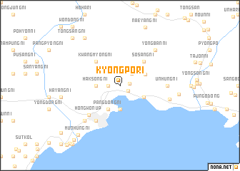
Kyŏngp'o-ri (Korea, North)Kyŏngp'o-ri is a town in Korea, North. An overview map of the region around Kyŏngp'o-ri is displayed below.
regional and 3d topo map of Kyŏngp'o-ri, Korea, North ::
Kyŏngp'o-ri airports ::
The nearest airport is SHO - Sokch'o Sokcho, located 219.8 km south of Kyŏngp'o-ri.
Nearby towns ::
Songnyŏng-ni (1.3km south east) //
Kyŏnghŭng-ni (1.2km east) //
Namyang-ni (1.4km west) //
Sinsŏng-ni (2.3km north east) //
Haksong-ni (2.8km west) //
Pangha-ri (3.7km south) //
Chunghŭng-ni (3.4km south east) //
Pangsŏ-ri (4.0km south) //
Pangdong-ni (4.0km south) //
Unsang-ni (3.5km north east) //
Kwangmyŏng-ni (4.7km north west) //
Kwandŏng-ni (4.7km north west) //
Sŏsang-ni (4.7km north east) //
Chŏnjin-nodongjagu (6.2km south west) //
Hongwŏn-ŭp (5.9km south west) //
Unhŭng-ni (5.7km east) //
Namch'ŏn-ni (7.0km south west) //
Yongban-ni (7.0km north east) //
Sansŏ-ri (6.3km east) //
Anp'ung-ni (8.5km north west) //
Munhŭng-ni (9.3km south west) //
Tongsang-ni (9.3km north west) //
Munho-ri (10.1km south west) //
[all distances 'as the bird flies' and approximate] 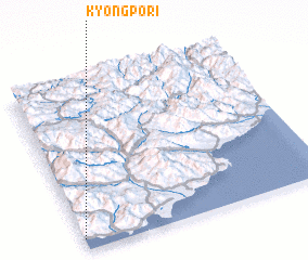 Places with similar names to Kyŏngp'o-ri, Korea, North ::
// Kyŏngp'a-ri (KP)
Disclaimer :: Information on this page comes without warranty of any kind |
||
|
Where is Kyŏngp'o-ri? Elevation and coordinates ::
Latitude (lat): 40°4'0"N Longitude (lon): 128°0'0"E
Elevation (approx.): 16m (map arrows pan, magnifying glasses zoom) |
||
|
Visiting Kyŏngp'o-ri? Hotel/Accommodation ::
Book a hotel in Kyŏngp'o-ri Travel Guide ::
rental cars ::
car rental offers GPS waypoint ::
download a GPX waypoint (PoI) of Kyŏngp'o-ri for your GPS receiver
|
||