|
search place name
|
||
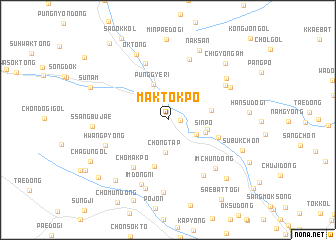
Maktŏkp'o (Hamgyŏng, Korea, North)Maktŏkp'o is a town in the Hamgyŏng region of Korea, North. An overview map of the region around Maktŏkp'o is displayed below.
regional and 3d topo map of Maktŏkp'o, Korea, North ::
Nearby towns ::
Oesimnijŏng (1.0km east) //
Simbong-dong (2.7km north east) //
Yŏt'un'gae (2.9km south east) //
Chŏngt'ap (3.7km south) //
P'unggye-ri (4.2km north) //
Sinp'o (3.4km south east) //
Sindong-ni (3.5km east) //
Changgunp'a (3.8km east) //
Sŏdu-gol (5.3km south) //
Norumogi (4.7km south east) //
Ch'omakp'o (6.0km south west) //
Sumunnae (6.6km north) //
Pangŭidŏgi (7.0km north) //
Chŏlgu-gol (6.9km south east) //
Ch'ongt'o-gol (6.2km north east) //
Hwangp'yong (6.0km south west) //
Imch'un-dong (6.8km south east) //
Imdong-ni (7.5km south) //
Swaedapp'o (6.4km north east) //
Samgŏri (7.8km south) //
Sedapp'o (6.8km north east) //
Ok-tong (7.7km north) //
Imdongjŏl-gol (8.1km south) //
Ssangbujae (6.4km west) //
Naksan (8.2km north) //
Araegŭm-ch'on (8.1km south west) //
Chigyŏngam (7.9km north east) //
Subuk-ch'on (7.2km south east) //
Sajŏng-ch'on (8.1km south east) //
[all distances 'as the bird flies' and approximate]  Places with similar names to Maktŏkp'o, Korea, North ::
// Magdaguup (PH)
Disclaimer :: Information on this page comes without warranty of any kind |
||
|
Where is Maktŏkp'o? Elevation and coordinates ::
Latitude (lat): 41°6'1"N Longitude (lon): 129°10'15"E
Elevation (approx.): 492m (map arrows pan, magnifying glasses zoom) |
||
|
Visiting Maktŏkp'o? Hotel/Accommodation ::
Book a hotel in Maktŏkp'o Travel Guide ::
rental cars ::
car rental offers GPS waypoint ::
download a GPX waypoint (PoI) of Maktŏkp'o for your GPS receiver
|
||