|
search place name
|
||
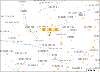
Pangŭidŏgi (Hamgyŏng, Korea, North)Pangŭidŏgi is a town in the Hamgyŏng region of Korea, North. An overview map of the region around Pangŭidŏgi is displayed below.
regional and 3d topo map of Pangŭidŏgi, Korea, North ::
Nearby towns ::
Naksan (1.3km north east) //
Minp'aedŏgi (2.9km north west) //
Chigyŏngam (3.1km east) //
Ungnam-dong (4.1km north) //
Simbong-dong (4.5km south) //
Sedapp'o (3.8km south east) //
P'unggye-ri (4.1km south west) //
Sumunnae (3.7km west) //
Ch'ongt'o-gol (4.3km south east) //
Ungju-dong (5.1km north) //
Swaedapp'o (4.7km south east) //
Ok-tong (4.4km west) //
Changgunp'a (6.0km south) //
Ch'ŏnhwa-dong (6.5km north) //
Oesimnijŏng (6.9km south) //
Kongjŏn-gol (5.6km north east) //
Maktŏkp'o (7.0km south) //
Sadŏk-kol (6.1km west) //
Ssangbong-dong (8.0km north) //
Sindong-ni (8.0km south) //
Pangp'o (6.3km east) //
Sinp'o (8.3km south) //
Yŏt'un'gae (8.4km south) //
Sangsosik-tong (7.5km north east) //
Hansudŏgi (7.8km south east) //
Norumogi (9.1km south) //
Mansin-dong (9.3km south east) //
Yŏngdogi (10.6km south east) //
[all distances 'as the bird flies' and approximate]  Places with similar names to Pangŭidŏgi, Korea, North ::
// Pingdijie (CN)
Disclaimer :: Information on this page comes without warranty of any kind |
||
|
Where is Pangŭidŏgi? Elevation and coordinates ::
Latitude (lat): 41°9'41"N Longitude (lon): 129°11'31"E
Elevation (approx.): 1126m (map arrows pan, magnifying glasses zoom) |
||
|
Visiting Pangŭidŏgi? Hotel/Accommodation ::
Book a hotel in Pangŭidŏgi Travel Guide ::
rental cars ::
car rental offers GPS waypoint ::
download a GPX waypoint (PoI) of Pangŭidŏgi for your GPS receiver
|
||