|
search place name
|
||
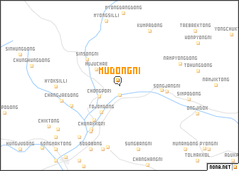
Mudŏng-ni (Chagang, Korea, North)Mudŏng-ni is a town in the Chagang region of Korea, North. An overview map of the region around Mudŏng-ni is displayed below.
regional and 3d topo map of Mudŏng-ni, Korea, North ::
Mudŏng-ni airports ::
The nearest airport is FNJ - Pyongyang Intl, located 222.4 km south west of Mudŏng-ni.
Nearby towns ::
Changgang-ŭp (1.5km south) //
Chongp'o-ri (3.0km south west) //
Mujuch'ae (3.7km north west) //
T'ojŏm-dong (4.7km south west) //
Sinsŏng-ni (5.6km north west) //
Sŏngjang-dong (5.1km east) //
Changp'yŏng-ni (6.2km south west) //
Sŏngjang-ni (5.7km east) //
Chumakkŏ-ri (7.6km south west) //
Changhang-dong (6.5km south west) //
Changja-dong (7.9km south west) //
Kŭmp'a-dong (9.3km north east) //
Pyŏng-dong (9.4km south west) //
[all distances 'as the bird flies' and approximate] 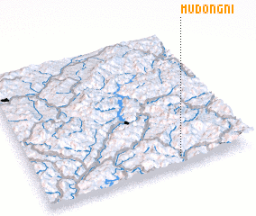 Places with similar names to Mudŏng-ni, Korea, North ::
Disclaimer :: Information on this page comes without warranty of any kind |
||
|
Where is Mudŏng-ni? Elevation and coordinates ::
Latitude (lat): 41°4'22"N Longitude (lon): 126°40'25"E
Elevation (approx.): 368m (map arrows pan, magnifying glasses zoom) |
||
|
Visiting Mudŏng-ni? Hotel/Accommodation ::
Book a hotel in Mudŏng-ni Travel Guide ::
rental cars ::
car rental offers GPS waypoint ::
download a GPX waypoint (PoI) of Mudŏng-ni for your GPS receiver
|
||