|
search place name
|
||
Namsong-dong (Hamgyŏng, Korea, North)Namsong-dong is a town in the Hamgyŏng region of Korea, North. An overview map of the region around Namsong-dong is displayed below.
regional and 3d topo map of Namsong-dong, Korea, North ::
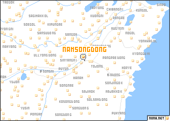
Nearby towns ::
Sangnyongsan (0.9km south west) //
Honam-ni (0.8km east) //
Namŭn-dong (1.2km east) //
Kangu (1.5km north east) //
Yongsan-dong (1.8km north west) //
Hagŏmun (2.0km south west) //
Yongnam-dong (2.5km north east) //
Yongju-dong (3.1km north) //
Kŏmun-dong (2.7km south west) //
Ha-dong (3.1km south west) //
Yangch'ŏl-li (3.0km south west) //
Hongga-gol (3.5km south) //
Sinyang-ni (2.8km west) //
Tojŏng (3.2km south east) //
Yongch'ŏn-dong (3.7km north) //
Parha-dong (3.5km north east) //
Haŏm-dong (4.4km north) //
Iŏm-ni (4.8km north) //
Hanam (5.1km south) //
Pandu-gol (4.1km west) //
Ch'op'yŏng (4.2km south east) //
Sangŏm (5.1km north west) //
Puyun (4.5km south west) //
Tolsinp'o (4.7km north west) //
Yanggyŏl-li (5.3km north east) //
Homun'gol (5.4km north) //
Sŏram (5.4km north east) //
Naruam (6.0km north) //
Subuk (6.4km north) //
[all distances 'as the bird flies' and approximate] 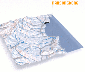 Places with similar names to Namsong-dong, Korea, North ::
Disclaimer :: Information on this page comes without warranty of any kind |
||
|
Where is Namsong-dong? Elevation and coordinates ::
Latitude (lat): 41°16'18"N Longitude (lon): 129°38'28"E
Elevation (approx.): 26m (map arrows pan, magnifying glasses zoom) |
||
|
Visiting Namsong-dong? Hotel/Accommodation ::
Book a hotel in Namsong-dong Travel Guide ::
rental cars ::
car rental offers GPS waypoint ::
download a GPX waypoint (PoI) of Namsong-dong for your GPS receiver
|
||