|
search place name
|
||
Sajin-dong (Hamgyŏng, Korea, North)Sajin-dong is a town in the Hamgyŏng region of Korea, North. An overview map of the region around Sajin-dong is displayed below.
regional and 3d topo map of Sajin-dong, Korea, North ::

Nearby towns ::
Namnyang-dong (2.8km north west) //
Noch'ang-ni (3.3km north) //
Sansŏp'o (3.8km north west) //
Yongje-dong (4.5km west) //
Samilp'o (4.7km west) //
Sunam-dong (6.9km north) //
Kajin-dong (6.7km north east) //
Samhae-dong (7.8km north) //
Majŏn-dong (6.8km south west) //
Ssangp'o-dong (7.4km south west) //
Nongsa-dong (7.5km north west) //
Pugŏ-ri (6.9km north west) //
Anssaakp'o-dong (7.2km south west) //
Yongdup'yong (10.7km south west) //
[all distances 'as the bird flies' and approximate] 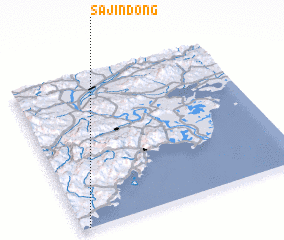 Places with similar names to Sajin-dong, Korea, North ::
// Segenting (MY)
// Cigintung (ID)
// Cigintung (ID)
// Cigintung (ID)
// Cijantung (ID)
// Segintong (ID)
// Segintung (ID)
// Sajin-dong (KP)
// Sajŏn-dong (KP)
// Sajŏn-dong (KP)
Disclaimer :: Information on this page comes without warranty of any kind |
||
|
Where is Sajin-dong? Elevation and coordinates ::
Latitude (lat): 42°0'4"N Longitude (lon): 130°1'39"E
Elevation (approx.): 27m (map arrows pan, magnifying glasses zoom) |
||
|
Visiting Sajin-dong? Hotel/Accommodation ::
Book a hotel in Sajin-dong Travel Guide ::
rental cars ::
car rental offers GPS waypoint ::
download a GPX waypoint (PoI) of Sajin-dong for your GPS receiver
|
||