|
search place name
|
||
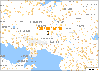
Sansŏng-dong (Hwanghae, Korea, North)Sansŏng-dong is a town in the Hwanghae region of Korea, North. An overview map of the region around Sansŏng-dong is displayed below.
regional and 3d topo map of Sansŏng-dong, Korea, North ::
Sansŏng-dong airports ::
The nearest airport is GMP - Seoul Gimpo, located 106.6 km south east of Sansŏng-dong.
Other airports nearby include FNJ - Pyongyang Intl (129.2 km north), SSN - Seoul East Seoul Ab (137.6 km south east), OSN - Osan Ab (155.6 km south east), Nearby towns ::
P'okp'o-dong (0.8km north east) //
Kunghyŏn-dong (1.5km north east) //
Sŭngma-dong (2.4km south) //
Paekhyŏn (2.4km north) //
Kosŏk-tong (2.1km east) //
Wŏndae (2.7km north east) //
Ong-dong (2.8km south west) //
Paenamu-gol (3.2km south) //
Chakch'ŏl-li (2.6km north east) //
Tonggi-dong (2.9km south east) //
Sumi-dong (3.1km north west) //
Ssangga-ri (3.6km south) //
Ŭn'gye-dong (3.9km south) //
Kkach'iwŏn-dong (3.2km east) //
Sugŏm-dong (3.8km south east) //
Pokchwi-gol (4.1km north) //
Kkach'inae-ri (3.3km east) //
Naengjŏng-ni (4.2km north) //
Sŏkch'ŏn-ni (4.0km south west) //
Hanu-dong (4.4km south) //
Yŏngyang-ni (4.4km south) //
Pŏriam (3.7km east) //
Sŏjae-gol (4.3km south east) //
Kan-dong (3.8km east) //
Sŏkch'ŏn-dong (4.7km south) //
Kwangsŏngmol (4.5km south west) //
Naesan-dong (3.8km west) //
Ch'ŏngp'ung-dong (4.0km west) //
Kang-ch'on (4.4km north east) //
[all distances 'as the bird flies' and approximate]  Places with similar names to Sansŏng-dong, Korea, North ::
// Sansang-dong (KP)
// Sansŏng-dong (KP)
// Sinsŏng-dong (KP)
// Sinsŏng-dong (KP)
// Sinsŏng-dong (KP)
// Sŏnsang-dong (KP)
// Sansŏng-dong (KR)
// Sansŏng-dong (KR)
// Sinsang-dong (KR)
// Sinsŏng-dong (KP)
Disclaimer :: Information on this page comes without warranty of any kind |
||
|
Where is Sansŏng-dong? Elevation and coordinates ::
Latitude (lat): 38°3'44"N Longitude (lon): 125°45'35"E
Elevation (approx.): 306m (map arrows pan, magnifying glasses zoom) |
||
|
Visiting Sansŏng-dong? Hotel/Accommodation ::
Book a hotel in Sansŏng-dong Travel Guide ::
rental cars ::
car rental offers GPS waypoint ::
download a GPX waypoint (PoI) of Sansŏng-dong for your GPS receiver
|
||