|
search place name
|
||
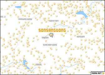
Sŏnsang-dong (Hwanghae, Korea, North)Sŏnsang-dong is a town in the Hwanghae region of Korea, North. An overview map of the region around Sŏnsang-dong is displayed below.
regional and 3d topo map of Sŏnsang-dong, Korea, North ::
Sŏnsang-dong airports ::
The nearest airport is FNJ - Pyongyang Intl, located 112.1 km north of Sŏnsang-dong.
Other airports nearby include GMP - Seoul Gimpo (133.5 km south east), SSN - Seoul East Seoul Ab (164.3 km south east), OSN - Osan Ab (182.8 km south east), Nearby towns ::
Mayu-dong (1.7km north west) //
Ch'ŏngsal-li (1.6km north west) //
Naeo-ri (2.3km south west) //
Sinjŏl-li (2.7km north) //
Sinhŭng-dong (3.4km north) //
Wŏndong-ni (2.8km east) //
Kŭmch'on-dong (3.8km south) //
Myŏngsa-dong (3.7km north west) //
Ch'ŏnggye-ri (3.5km north west) //
Myŏngsang-dong (3.1km east) //
Hyŏram-dong (4.1km north) //
Changch'on (4.2km south) //
Ibam-dong (4.3km north) //
Kuryong-dong (4.1km south east) //
Somul-tong (4.4km south) //
Sŏkkyo-ri (4.9km north) //
Sangwŏn-dong (4.0km north east) //
Kandong-ni (4.2km north east) //
Pŏlmal (5.0km south) //
Chihyŏn-dong (5.1km north) //
Hoam-ni (4.6km north east) //
Chinam-ni (4.2km west) //
Toae-dong (4.4km south east) //
Chahyŏn-dong (4.4km south east) //
Maesan-dong (4.6km south east) //
Nae-dong (4.6km south east) //
San-dong (4.4km west) //
Hawŏn-dong (4.8km north east) //
Chigan-dong (5.7km north east) //
[all distances 'as the bird flies' and approximate] 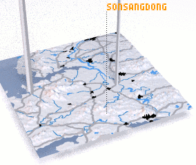 Places with similar names to Sŏnsang-dong, Korea, North ::
// Sansang-dong (KP)
// Sansŏng-dong (KP)
// Sansŏng-dong (KP)
// Sinsŏng-dong (KP)
// Sinsŏng-dong (KP)
// Sinsŏng-dong (KP)
// Sansŏng-dong (KR)
// Sansŏng-dong (KR)
// Sinsang-dong (KR)
// Sinsŏng-dong (KP)
Disclaimer :: Information on this page comes without warranty of any kind |
||
|
Where is Sŏnsang-dong? Elevation and coordinates ::
Latitude (lat): 38°13'16"N Longitude (lon): 125°31'25"E
Elevation (approx.): 234m (map arrows pan, magnifying glasses zoom) |
||
|
Visiting Sŏnsang-dong? Hotel/Accommodation ::
Book a hotel in Sŏnsang-dong Travel Guide ::
rental cars ::
car rental offers GPS waypoint ::
download a GPX waypoint (PoI) of Sŏnsang-dong for your GPS receiver
|
||