|
search place name
|
||
Yongjŏng-ni (Kangwŏn, Korea, North)Yongjŏng-ni is a town in the Kangwŏn region of Korea, North. An overview map of the region around Yongjŏng-ni is displayed below.
regional and 3d topo map of Yongjŏng-ni, Korea, North ::

Yongjŏng-ni airports ::
The nearest airport is FNJ - Pyongyang Intl, located 143.4 km west of Yongjŏng-ni.
Other airports nearby include SHO - Sokch'o Sokcho (169.8 km south east), GMP - Seoul Gimpo (199.5 km south), SSN - Seoul East Seoul Ab (207.3 km south), KAG - Kangnung Gangneung (222.5 km south east), Nearby towns ::
Samsŏng-ni (0.7km south west) //
Sŏkhyŏl-li (0.9km south) //
Kuhang-ni (0.7km west) //
Hoeam-ni (1.0km south west) //
Chugyo-ri (1.6km south west) //
Tangmoro-ri (1.5km east) //
Onggoji (1.8km north west) //
Yongt'al-li (2.0km south) //
Yongyŏn (2.5km south) //
Hamp'yŏng-ni (2.5km north) //
Songjae-ri (2.1km west) //
Songt'al-li (2.6km south east) //
Nŭngjŏn-ni (2.4km north west) //
Ongnyu-dong (2.7km south east) //
Sinsong-ni (2.8km north west) //
Chukchŏl-li (3.3km north) //
Yongp'yŏng-ni (3.3km south) //
Sangp'yŏng (3.0km south east) //
Okchŏng-ni (3.0km south east) //
Sŭngyang-ni (3.6km south) //
Ok'pyŏng-dong (3.0km south west) //
Nongam (3.5km south west) //
Pomokchŏng-ni (3.1km north west) //
Myŏngu-ri (3.6km north east) //
Hwangsŏng-ni (3.2km south east) //
Nŭngjang-ni (4.0km north) //
Yangji-ri (4.3km south) //
Sangjang-dong (3.4km east) //
Taedong-ni (4.5km north) //
[all distances 'as the bird flies' and approximate] 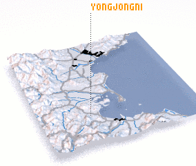 Places with similar names to Yongjŏng-ni, Korea, North ::
// Hyangjŏng-ni (KP)
// Hyangjŏng-ni (KP)
// Yangjang-ni (KP)
// Yangjŏng-ni (KP)
// Yangjŏng-ni (KP)
// Yangjung-ni (KP)
// Yongjang-ni (KP)
// Yŏngjŏng-ni (KP)
// Yongjŏng-ni (KP)
// Yongjŏng-ni (KP)
Disclaimer :: Information on this page comes without warranty of any kind |
||
|
Where is Yongjŏng-ni? Elevation and coordinates ::
Latitude (lat): 39°18'19"N Longitude (lon): 127°19'44"E
Elevation (approx.): 18m (map arrows pan, magnifying glasses zoom) |
||
|
Visiting Yongjŏng-ni? Hotel/Accommodation ::
Book a hotel in Yongjŏng-ni Travel Guide ::
rental cars ::
car rental offers GPS waypoint ::
download a GPX waypoint (PoI) of Yongjŏng-ni for your GPS receiver
|
||