|
search place name
|
||
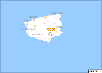
Sa-ri (Kyŏngsang, Korea, South)Sa-ri is a town in the Kyŏngsang region of Korea, South. An overview map of the region around Sa-ri is displayed below.
regional and 3d topo map of Sa-ri, Korea, South ::
Sa-ri airports ::
The nearest airport is KAG - Kangnung Gangneung, located 174.2 km west of Sa-ri.
Other airports nearby include KPO - Pohang (209.8 km south west), USN - Ulsan (249.0 km south west), Nearby towns ::
Chungnyŏng (0.7km south west) //
Kallyŏng (1.3km south west) //
To-dong (2.4km north east) //
Ullŭng (2.7km north east) //
Chŏ-ri (3.4km north east) //
Namyang-ni (3.8km west) //
Albong (5.2km north west) //
Nari-dong (5.6km north) //
Sŏdallyŏng (6.1km north west) //
Chusan (7.4km north) //
Ch'ang-dong (7.6km north) //
Sŏkp'o-dong (7.7km north) //
Ch'ŏnbu-ri (7.8km north) //
Kuam (6.4km west) //
Such'ŭng-dong (6.8km west) //
Hyŏnp'o-ri (7.9km north west) //
T'aeha-ri (8.4km north west) //
[all distances 'as the bird flies' and approximate]  Places with similar names to Sa-ri, Korea, South ::
Disclaimer :: Information on this page comes without warranty of any kind |
||
|
Where is Sa-ri? Elevation and coordinates ::
Latitude (lat): 37°28'0"N Longitude (lon): 130°53'0"E
Elevation (approx.): -32768m (map arrows pan, magnifying glasses zoom) |
||
|
Visiting Sa-ri? Hotel/Accommodation ::
Book a hotel in Sa-ri Travel Guide ::
rental cars ::
car rental offers GPS waypoint ::
download a GPX waypoint (PoI) of Sa-ri for your GPS receiver
|
||