|
search place name
|
||
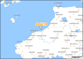
Sŏdut'ŏ (Korea, South)Sŏdut'ŏ is a town in Korea, South. An overview map of the region around Sŏdut'ŏ is displayed below.
regional and 3d topo map of Sŏdut'ŏ, Korea, South ::
Sŏdut'ŏ airports ::
The nearest airport is KUB - Kunsan Ab, located 23.0 km north of Sŏdut'ŏ.
Other airports nearby include KWJ - Kwangju Gwangju (67.3 km south), RSU - Yeosu (134.8 km south east), OSN - Osan Ab (159.8 km north), YEC - Yechon Yecheon (191.3 km north east), Nearby towns ::
Paengnyŏl-li (2.6km east) //
Taehang-ni (3.0km south west) //
Kunmak-tong (3.7km south) //
Chunggye-ri (4.4km south) //
Chi-dong (4.8km south west) //
Chisŏ-ri (4.9km south west) //
Changsin (4.9km east) //
Ch'ŏngnim-ni (6.6km south east) //
Namsŏng-dong (6.3km east) //
Yongwa-dong (6.3km east) //
Nojŏng-ni (7.2km south east) //
Kosap'o (7.2km south west) //
Changsil-li (7.2km north east) //
Map'o-ri (8.0km south west) //
Tonji-ri (8.2km north east) //
Ŭibong-ni (8.8km north east) //
Yuyu-dong (9.6km south west) //
[all distances 'as the bird flies' and approximate] 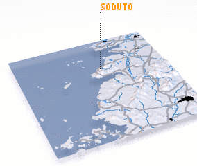 Places with similar names to Sŏdut'ŏ, Korea, South ::
Disclaimer :: Information on this page comes without warranty of any kind |
||
|
Where is Sŏdut'ŏ? Elevation and coordinates ::
Latitude (lat): 35°42'0"N Longitude (lon): 126°34'0"E
Elevation (approx.): -32768m (map arrows pan, magnifying glasses zoom) |
||
|
Visiting Sŏdut'ŏ? Hotel/Accommodation ::
Book a hotel in Sŏdut'ŏ Travel Guide ::
rental cars ::
car rental offers GPS waypoint ::
download a GPX waypoint (PoI) of Sŏdut'ŏ for your GPS receiver
|
||