|
search place name
|
||
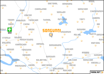
Sŏngŭn-ni (Kyŏnggi, Korea, South)Sŏngŭn-ni is a town in the Kyŏnggi region of Korea, South. An overview map of the region around Sŏngŭn-ni is displayed below.
regional and 3d topo map of Sŏngŭn-ni, Korea, South ::
Sŏngŭn-ni airports ::
The nearest airport is OSN - Osan Ab, located 12.5 km west of Sŏngŭn-ni.
Other airports nearby include SSN - Seoul East Seoul Ab (42.3 km north), GMP - Seoul Gimpo (63.9 km north west), YEC - Yechon Yecheon (116.4 km south east), KUB - Kunsan Ab (138.2 km south), Nearby towns ::
Yangsŏng (3.0km east) //
Sŏngha-dong (3.9km south) //
Myŏngdang-ni (3.7km east) //
Wŏndoil (4.8km south west) //
Twin-mal (5.4km north) //
Nŭt'ijŏng (6.3km north east) //
Changsŏ-ri (6.0km north east) //
Wagok (6.2km west) //
Sanggach'ŏn (6.4km south west) //
Sŭngdu-ri (8.0km south) //
Sin-ch'on (7.2km south east) //
Namsan-dong (8.2km north) //
Tongmak (6.6km west) //
Tongch'ŏn (7.5km north west) //
Songjŏn (8.5km north) //
Tang-ch'on (8.6km south east) //
Kohyŏn (9.8km north west) //
P'yŏngt'aek (10.6km south west) //
[all distances 'as the bird flies' and approximate] 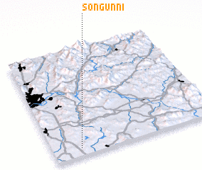 Places with similar names to Sŏngŭn-ni, Korea, South ::
Disclaimer :: Information on this page comes without warranty of any kind |
||
|
Where is Sŏngŭn-ni? Elevation and coordinates ::
Latitude (lat): 37°4'0"N Longitude (lon): 127°10'0"E
Elevation (approx.): 117m (map arrows pan, magnifying glasses zoom) |
||
|
Visiting Sŏngŭn-ni? Hotel/Accommodation ::
Book a hotel in Sŏngŭn-ni Travel Guide ::
rental cars ::
car rental offers GPS waypoint ::
download a GPX waypoint (PoI) of Sŏngŭn-ni for your GPS receiver
|
||