|
search place name
|
||
Terre-de-Bas (Guadeloupe, Guadeloupe)Terre-de-Bas is a town in the Guadeloupe region of Guadeloupe. An overview map of the region around Terre-de-Bas is displayed below.
regional and 3d topo map of Terre-de-Bas, Guadeloupe ::

Terre-de-Bas airports ::
The nearest airport is PTP - Pointe-a-pitre Le Raizet, located 47.2 km north of Terre-de-Bas.
Other airports nearby include DOM - Dominica Melville Hall (49.0 km south east), DCF - Canefield (62.4 km south east), ANU - Antigua V C Bird Intl (143.4 km north), FDF - Fort-de-france Le Lamentin (154.9 km south east), Nearby towns ::
Petites-Anses (0.0km north) //
Grande Anse (1.8km east) //
Terre-de-Haut (7.4km east) //
[all distances 'as the bird flies' and approximate] 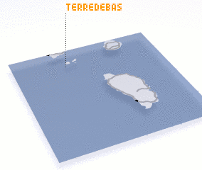 Places with similar names to Terre-de-Bas, Guadeloupe ::
// Dordabis (NA)
// Tortebesse (FR)
// Torre deʼ Busi (IT)
// De Rietbos (BE)
// Trou du Bois (BE)
// Trou du Bois (BE)
// Trou du Bois (BE)
// Trou du Bois (BE)
// Trou-du-Bois (BE)
Disclaimer :: Information on this page comes without warranty of any kind |
||
|
Where is Terre-de-Bas? Elevation and coordinates ::
Latitude (lat): 15°51'0"N Longitude (lon): 61°38'0"W
Elevation (approx.): 210m (map arrows pan, magnifying glasses zoom) |
||
|
Visiting Terre-de-Bas? Hotel/Accommodation ::
Book a hotel in Terre-de-Bas Travel Guide ::
Buy a travel guide for Guadeloupe rental cars ::
car rental offers GPS waypoint ::
download a GPX waypoint (PoI) of Terre-de-Bas for your GPS receiver
|
||