|
search place name
|
||
Dordabis (Khomas, Namibia)Dordabis is a town in the Khomas region of Namibia. An overview map of the region around Dordabis is displayed below.
regional and 3d topo map of Dordabis, Namibia ::

Nearby towns ::
Hatsamas (3.7km north) //
Stinkwater (8.2km north west) //
[all distances 'as the bird flies' and approximate] 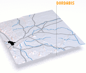 Places with similar names to Dordabis, Namibia ::
// Terre-de-Bas (GP)
// Tortebesse (FR)
// Torre deʼ Busi (IT)
// De Rietbos (BE)
// Trou du Bois (BE)
// Trou du Bois (BE)
// Trou du Bois (BE)
// Trou du Bois (BE)
// Trou-du-Bois (BE)
Disclaimer :: Information on this page comes without warranty of any kind |
||
|
Where is Dordabis? Elevation and coordinates ::
Latitude (lat): 22°57'0"S Longitude (lon): 17°36'0"E
Elevation (approx.): 1568m (map arrows pan, magnifying glasses zoom) |
||
|
Visiting Dordabis? Hotel/Accommodation ::
Book a hotel in Dordabis Travel Guide ::
Buy a travel guide for Namibia rental cars ::
car rental offers GPS waypoint ::
download a GPX waypoint (PoI) of Dordabis for your GPS receiver
|
||