|
search place name
|
||
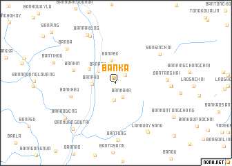
Ban Ka (Phôngsali, Laos)Ban Ka is a town in the Phôngsali region of Laos. An overview map of the region around Ban Ka is displayed below.
regional and 3d topo map of Ban Ka, Laos ::
Ban Ka airports ::
The nearest airport is THL - Tachilek Tachileik, located 274.2 km south west of Ban Ka.
Nearby towns ::
Ban Kha Poué Chi (1.9km north east) //
Ban Maha (2.5km south east) //
Ban Chompho (2.8km south) //
Ban Pèk (3.2km north west) //
Ban Pék (3.7km north) //
Ban Pho (3.6km west) //
Ban Nagnao (4.6km north west) //
Ban Hin (6.7km west) //
Ban Kheu (7.1km west) //
Ban Tanghai (7.7km east) //
Ban Sinchai (8.0km north east) //
Ban Botay (8.5km north west) //
Si Chao Tang (8.2km east) //
Ban Nakông (8.9km north west) //
Ban Xichachay (9.1km south east) //
La Mouay Sang (9.3km south east) //
Ban Ma (9.2km north west) //
Ban Bodèng (9.4km south west) //
Ban Muang-Ou-Tai (9.9km south west) //
[all distances 'as the bird flies' and approximate]  Places with similar names to Ban Ka, Laos ::
Disclaimer :: Information on this page comes without warranty of any kind |
||
|
Where is Ban Ka? Elevation and coordinates ::
Latitude (lat): 22°11'18"N Longitude (lon): 101°51'13"E
Elevation (approx.): 1240m (map arrows pan, magnifying glasses zoom) |
||
|
Visiting Ban Ka? Hotel/Accommodation ::
Book a hotel in Ban Ka Travel Guide ::
Buy a travel guide for Laos rental cars ::
car rental offers GPS waypoint ::
download a GPX waypoint (PoI) of Ban Ka for your GPS receiver
|
||