|
search place name
|
||
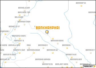
Ban Khamphai (Laos)Ban Khamphai is a town in Laos. An overview map of the region around Ban Khamphai is displayed below.
regional and 3d topo map of Ban Khamphai, Laos ::
Ban Khamphai airports ::
The nearest airport is VTE - Vientiane Wattay Intl, located 144.1 km south west of Ban Khamphai.
Other airports nearby include SNO - Sakon Nakhon (147.9 km south), UTH - Udon Thani (164.5 km south west), LPQ - Luang Prabang Luang Phabang Intl (233.0 km north west), ZVK - Savannakhet (237.2 km south east), Nearby towns ::
Ban Na Khau Lôm (2.6km south east) //
Ban Na-Ô (4.0km north west) //
Ban Kham Bône (5.1km south east) //
Ban Na Hom (5.8km south) //
Ban Na Hinu (1) (7.6km south) //
Ban Boki (9.0km south east) //
Ban Namai (9.0km south east) //
Ban Nongboua (9.1km south west) //
Nadi (9.0km south west) //
[all distances 'as the bird flies' and approximate] 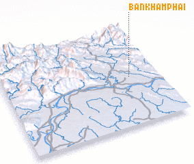 Places with similar names to Ban Khamphai, Laos ::
// Ban Kham Phai (TH)
// Ban Kham Phai (TH)
// Ban Kham Pha-O (TH)
// Ban Kham Phu (TH)
// Ban Kham Phu (TH)
// Ban Khamphè (LA)
// Ban Khamphô (LA)
// Ban Khamva (LA)
Disclaimer :: Information on this page comes without warranty of any kind |
||
|
Where is Ban Khamphai? Elevation and coordinates ::
Latitude (lat): 18°30'0"N Longitude (lon): 103°49'0"E
Elevation (approx.): 177m (map arrows pan, magnifying glasses zoom) |
||
|
Visiting Ban Khamphai? Hotel/Accommodation ::
Book a hotel in Ban Khamphai Travel Guide ::
Buy a travel guide for Laos rental cars ::
car rental offers GPS waypoint ::
download a GPX waypoint (PoI) of Ban Khamphai for your GPS receiver
|
||