|
search place name
|
||
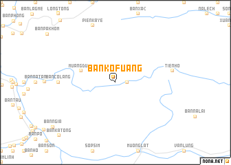
Ban Kofuang (Houaphan, Laos)Ban Kofuang is a town in the Houaphan region of Laos. An overview map of the region around Ban Kofuang is displayed below.
regional and 3d topo map of Ban Kofuang, Laos ::
Ban Kofuang airports ::
The nearest airport is HAN - Hanoi Noibai Intl, located 144.5 km north east of Ban Kofuang.
Nearby towns ::
Ban Vangngak (1.7km east) //
Ban Xaykhao (2.5km north east) //
Muang Dung (5.5km west) //
[all distances 'as the bird flies' and approximate] 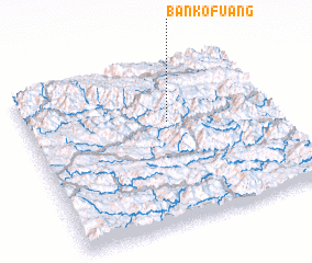 Places with similar names to Ban Kofuang, Laos ::
// Ban Kaphuang (TH)
// Bongvong (NG)
// Ban Kaphong (LA)
// Ban Kavang (LA)
// Ban Nakaphoung (LA)
// Bang Veng (VN)
// Bản Kéo Phung (VN)
// Bingfang (CN)
Disclaimer :: Information on this page comes without warranty of any kind |
||
|
Where is Ban Kofuang? Elevation and coordinates ::
Latitude (lat): 20°38'0"N Longitude (lon): 104°34'0"E
Elevation (approx.): 550m (map arrows pan, magnifying glasses zoom) |
||
|
Visiting Ban Kofuang? Hotel/Accommodation ::
Book a hotel in Ban Kofuang Travel Guide ::
Buy a travel guide for Laos rental cars ::
car rental offers GPS waypoint ::
download a GPX waypoint (PoI) of Ban Kofuang for your GPS receiver
|
||