|
search place name
|
||
Muang Dung (Laos)Muang Dung is a town in Laos. An overview map of the region around Muang Dung is displayed below.
regional and 3d topo map of Muang Dung, Laos ::

Muang Dung airports ::
The nearest airport is HAN - Hanoi Noibai Intl, located 148.4 km north east of Muang Dung.
Nearby towns ::
Ban Co Kien (3.9km south west) //
Ban Co Lang (3.9km south west) //
Ban Kofuang (5.5km east) //
Ban Muangdung (5.9km west) //
Ban Xaykhao (6.9km east) //
Ban Vangngak (7.2km east) //
Pien Kaye (7.6km north) //
Ban Na Tan (7.2km west) //
Ban Pakhôm (7.9km north west) //
Ban Pahang (8.8km north) //
Ban Phiangngè (8.6km west) //
[all distances 'as the bird flies' and approximate] 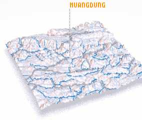 Places with similar names to Muang Dung, Laos ::
// Maingdaung (MM)
// Manaogahtawng (MM)
// Mangtong (MM)
// Mān Kiu-htang (MM)
// Maungdaung (MM)
// Maungdaung (MM)
// Meungtung (MM)
// Mōng Tong (MM)
// Möng Tung (MM)
// Möng Tawng (MM)
Disclaimer :: Information on this page comes without warranty of any kind |
||
|
Where is Muang Dung? Elevation and coordinates ::
Latitude (lat): 20°39'0"N Longitude (lon): 104°31'0"E
Elevation (approx.): 616m (map arrows pan, magnifying glasses zoom) |
||
|
Visiting Muang Dung? Hotel/Accommodation ::
Book a hotel in Muang Dung Travel Guide ::
Buy a travel guide for Laos rental cars ::
car rental offers GPS waypoint ::
download a GPX waypoint (PoI) of Muang Dung for your GPS receiver
|
||