|
search place name
|
||
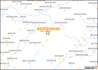
Ban Namphak (Oudômxai, Laos)Ban Namphak is a town in the Oudômxai region of Laos. An overview map of the region around Ban Namphak is displayed below.
regional and 3d topo map of Ban Namphak, Laos ::
Ban Namphak airports ::
The nearest airport is LPQ - Luang Prabang Luang Phabang Intl, located 95.7 km east of Ban Namphak.
Other airports nearby include THL - Tachilek Tachileik (146.0 km west), KET - Kengtung (216.8 km north west), PRH - Phrae (245.6 km south west), LPT - Lampang (273.6 km south west), Nearby towns ::
Ban Tangya (1.4km north west) //
Ban Phousan (2.0km south) //
Ban Longlou (2.4km north west) //
Ban Phoutoum (3.4km north) //
Ban Konglang (4.5km south west) //
Ban Kangmuang (5.2km north west) //
Ban Houakèng (5.8km north east) //
Ban Phangam (6.2km north east) //
Ban Kongvan (6.2km south west) //
Ban Dua (6.7km west) //
Ban Kalôm (8.8km north west) //
Ban Môkpai (9.0km north east) //
Ban Namtè (9.4km north) //
Ban Oudôm (9.6km south east) //
Ban Namphou (9.6km south east) //
Ban Nammao (11.4km south east) //
[all distances 'as the bird flies' and approximate] 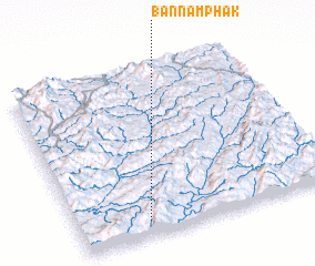 Places with similar names to Ban Namphak, Laos ::
// Ban Mae Phuak (TH)
// Ban Namphak (LA)
// Ban Namphak (LA)
// Ban Namphouk (LA)
// Ban Namphuk (LA)
Disclaimer :: Information on this page comes without warranty of any kind |
||
|
Where is Ban Namphak? Elevation and coordinates ::
Latitude (lat): 20°5'14"N Longitude (lon): 101°16'6"E
Elevation (approx.): 1185m (map arrows pan, magnifying glasses zoom) |
||
|
Visiting Ban Namphak? Hotel/Accommodation ::
Book a hotel in Ban Namphak Travel Guide ::
Buy a travel guide for Laos rental cars ::
car rental offers GPS waypoint ::
download a GPX waypoint (PoI) of Ban Namphak for your GPS receiver
|
||