|
search place name
|
||
Ban Phamuang (Khammouan, Laos)Ban Phamuang is a town in the Khammouan region of Laos. An overview map of the region around Ban Phamuang is displayed below.
regional and 3d topo map of Ban Phamuang, Laos ::

Ban Phamuang airports ::
The nearest airport is SNO - Sakon Nakhon, located 125.2 km south west of Ban Phamuang.
Other airports nearby include ZVK - Savannakhet (172.7 km south), Nearby towns ::
Ban Thông (3.4km north west) //
Ban Nongxông (4.3km north west) //
Ban Phônngam (4.4km south east) //
Ban Khonkèn (5.0km south east) //
Ban Kengkang (7.6km north west) //
Ban Pompèk (9.2km north east) //
Ban Heuana (10.0km north east) //
Ban Namngoy (10.1km south east) //
Ban Tônxan (10.2km north east) //
Ban Phôn (10.7km north east) //
Ban Bông (11.2km north east) //
[all distances 'as the bird flies' and approximate] 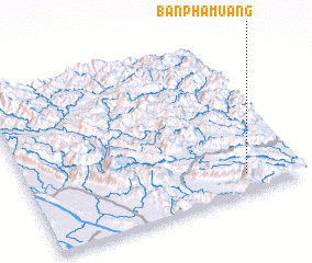 Places with similar names to Ban Phamuang, Laos ::
// Ban Phai Mung (TH)
// Ban Pha Mong (TH)
// Ban Pha Muang (TH)
// Ban Phoumiang (LA)
// Ban Phoumiang (LA)
// Ban Phoumouang (LA)
// Ban Phoumuang (LA)
// Bản Phou Muong (VN)
// Ban Phum Ma Ang (VN)
Disclaimer :: Information on this page comes without warranty of any kind |
||
|
Where is Ban Phamuang? Elevation and coordinates ::
Latitude (lat): 18°7'0"N Longitude (lon): 104°48'13"E
Elevation (approx.): 425m (map arrows pan, magnifying glasses zoom) |
||
|
Visiting Ban Phamuang? Hotel/Accommodation ::
Book a hotel in Ban Phamuang Travel Guide ::
Buy a travel guide for Laos rental cars ::
car rental offers GPS waypoint ::
download a GPX waypoint (PoI) of Ban Phamuang for your GPS receiver
|
||