|
search place name
|
||
Ban Phoumuang (Phôngsali, Laos)Ban Phoumuang is a town in the Phôngsali region of Laos. An overview map of the region around Ban Phoumuang is displayed below.
regional and 3d topo map of Ban Phoumuang, Laos ::

Ban Phoumuang airports ::
The nearest airport is LPQ - Luang Prabang Luang Phabang Intl, located 216.9 km south of Ban Phoumuang.
Nearby towns ::
Ban Pou Tchin (0.6km east) //
Oa Tai (2.2km south west) //
Ban Mai (3.1km south) //
Ban To Nam (4.6km north west) //
Ban Pu Sum (4.6km west) //
Ban Muangva (5.0km north) //
Keng Va (5.5km north) //
Ban Na Toum (5.6km north) //
Ban Sen Kham (6.6km west) //
Chang Fu Tsu (7.3km south west) //
Tin Chay (8.0km south) //
Houa Khan (8.0km south) //
P'u Yo (8.8km north west) //
Ban Phougnôt (10.4km north west) //
Ban Laophouchai (11.4km south east) //
[all distances 'as the bird flies' and approximate] 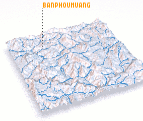 Places with similar names to Ban Phoumuang, Laos ::
// Ban Phai Mung (TH)
// Ban Pha Mong (TH)
// Ban Pha Muang (TH)
// Ban Phamuang (LA)
// Ban Phoumiang (LA)
// Ban Phoumiang (LA)
// Ban Phoumouang (LA)
// Bản Phou Muong (VN)
// Ban Phum Ma Ang (VN)
Disclaimer :: Information on this page comes without warranty of any kind |
||
|
Where is Ban Phoumuang? Elevation and coordinates ::
Latitude (lat): 21°51'3"N Longitude (lon): 102°19'39"E
Elevation (approx.): 738m (map arrows pan, magnifying glasses zoom) |
||
|
Visiting Ban Phoumuang? Hotel/Accommodation ::
Book a hotel in Ban Phoumuang Travel Guide ::
Buy a travel guide for Laos rental cars ::
car rental offers GPS waypoint ::
download a GPX waypoint (PoI) of Ban Phoumuang for your GPS receiver
|
||