|
search place name
|
||
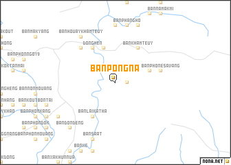
Ban Pông-Na (Laos)Ban Pông-Na is a town in Laos. An overview map of the region around Ban Pông-Na is displayed below.
regional and 3d topo map of Ban Pông-Na, Laos ::
Ban Pông-Na airports ::
The nearest airport is ZVK - Savannakhet, located 60.3 km west of Ban Pông-Na.
Other airports nearby include SNO - Sakon Nakhon (141.2 km north west), PKZ - Pakse (175.2 km south), Nearby towns ::
Ban Phônsavang (1.8km east) //
Ban Pôngdông (1.9km north) //
Ban Chèlamong Tai (2.6km north east) //
Ban Dôngkhoang (2.6km north west) //
Ban Nanôkkhian (5.6km east) //
Ban Phônbôk (5.6km east) //
Ban Dôngphilô (5.8km north) //
Ban Khamteuy (6.6km north east) //
Ban Laikatha (6.6km south west) //
Dônghén (6.6km north west) //
Ban Phone Savang (7.3km east) //
Bung Kha (7.7km north west) //
Ban Houay Khamteuy (9.1km north west) //
Ban Dondèng (10.3km south west) //
[all distances 'as the bird flies' and approximate] 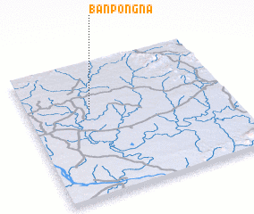 Places with similar names to Ban Pông-Na, Laos ::
// Ban Pang Noi (TH)
// Ban Ping Nai (TH)
// Ban Ping Nai (TH)
// Ban Pong Noi (TH)
// Ban Pong Noi (TH)
// Ban Pong Nua (TH)
// Ban Pong Nua (TH)
// Ban Pung Noi (TH)
// Ban Napang-Nua (LA)
// Ban Pong-Nua (LA)
Disclaimer :: Information on this page comes without warranty of any kind |
||
|
Where is Ban Pông-Na? Elevation and coordinates ::
Latitude (lat): 16°39'0"N Longitude (lon): 105°19'0"E
Elevation (approx.): 153m (map arrows pan, magnifying glasses zoom) |
||
|
Visiting Ban Pông-Na? Hotel/Accommodation ::
Book a hotel in Ban Pông-Na Travel Guide ::
Buy a travel guide for Laos rental cars ::
car rental offers GPS waypoint ::
download a GPX waypoint (PoI) of Ban Pông-Na for your GPS receiver
|
||