|
search place name
|
||
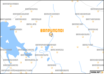
Ban Pung Noi (Sakon Nakhon, Thailand)Ban Pung Noi is a town in the Sakon Nakhon region of Thailand. An overview map of the region around Ban Pung Noi is displayed below.
regional and 3d topo map of Ban Pung Noi, Thailand ::
Ban Pung Noi airports ::
The nearest airport is SNO - Sakon Nakhon, located 22.8 km west of Ban Pung Noi.
Other airports nearby include ZVK - Savannakhet (84.5 km south east), UTH - Udon Thani (165.6 km west), VTE - Vientiane Wattay Intl (207.2 km north west), Nearby towns ::
Ban Phon (3.7km south) //
Ban Non Kung (4.0km north east) //
Ban Na Tong Noi (5.1km south west) //
Ban Pa Phang (5.1km south west) //
Ban Chiang Su (5.8km south) //
Ban Hin Chanaen (7.4km north) //
Ban Na Dua (7.7km north west) //
Ban Klang (8.0km north west) //
Ban Khok Sung (8.2km south west) //
[all distances 'as the bird flies' and approximate] 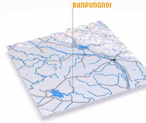 Places with similar names to Ban Pung Noi, Thailand ::
// Ban Pang Noi (TH)
// Ban Ping Nai (TH)
// Ban Ping Nai (TH)
// Ban Pong Noi (TH)
// Ban Pong Noi (TH)
// Ban Pong Nua (TH)
// Ban Pong Nua (TH)
// Ban Napang-Nua (LA)
// Ban Pông-Na (LA)
// Ban Pong-Nua (LA)
Disclaimer :: Information on this page comes without warranty of any kind |
||
|
Where is Ban Pung Noi? Elevation and coordinates ::
Latitude (lat): 17°12'0"N Longitude (lon): 104°20'0"E
Elevation (approx.): 161m (map arrows pan, magnifying glasses zoom) |
||
|
Visiting Ban Pung Noi? Hotel/Accommodation ::
Book a hotel in Ban Pung Noi Travel Guide ::
Buy a travel guide for Thailand rental cars ::
car rental offers GPS waypoint ::
download a GPX waypoint (PoI) of Ban Pung Noi for your GPS receiver
|
||