|
search place name
|
||
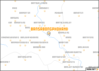
Ban Sabong-Phoham (1) (Laos)Ban Sabong-Phoham (1) is a town in Laos. An overview map of the region around Ban Sabong-Phoham (1) is displayed below.
regional and 3d topo map of Ban Sabong-Phoham (1), Laos ::
Ban Sabong-Phoham (1) airports ::
The nearest airport is PKZ - Pakse, located 137.8 km south west of Ban Sabong-Phoham (1).
Other airports nearby include DAD - Danang Intl (165.8 km east), ZVK - Savannakhet (209.7 km west), Nearby towns ::
Ban Sabong-Phoham (2) (2.6km south west) //
Ban Ralao (4.0km north east) //
Ban Kang (4.1km north west) //
Ban Tapung (5.1km north west) //
Ban Sabong-Kôk-Hai (5.1km south west) //
Ban Paléng (5.3km east) //
Ban Taloung-Loy (6.5km north east) //
Ban Pitian (6.5km south east) //
Ban Bông-Nam (6.6km south west) //
Ban Sala (7.4km west) //
A Rang (7.4km east) //
Ban Lavi-Phokaming (7.4km west) //
Pe Hourr (8.2km north east) //
Ban Kayô (9.1km south east) //
Ban Houn (1) (9.1km north west) //
[all distances 'as the bird flies' and approximate] 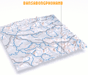 Places with similar names to Ban Sabong-Phoham (1), Laos :: Disclaimer :: Information on this page comes without warranty of any kind |
||
|
Where is Ban Sabong-Phoham (1)? Elevation and coordinates ::
Latitude (lat): 16°3'0"N Longitude (lon): 106°39'0"E
Elevation (approx.): 381m (map arrows pan, magnifying glasses zoom) |
||
|
Visiting Ban Sabong-Phoham (1)? Hotel/Accommodation ::
Book a hotel in Ban Sabong-Phoham (1) Travel Guide ::
Buy a travel guide for Laos rental cars ::
car rental offers GPS waypoint ::
download a GPX waypoint (PoI) of Ban Sabong-Phoham (1) for your GPS receiver
|
||